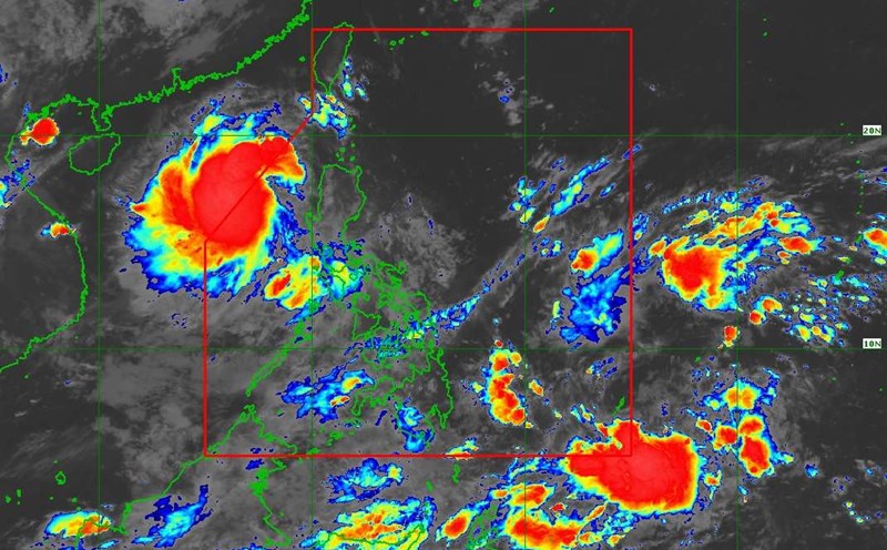
According to the new low pressure forecast from the National Center for Hydro-Meteorological Forecasting, a low pressure area is active in the eastern sea of the Philippines right after storm No. 5 made landfall.
Location at 1:00 p.m. on August 26 was about 15.5-16.5°N; 123.5-124.5°E.
In the next 24-36 hours, the low pressure area will move West Northwest, at a speed of 15-20km/h, entering the eastern sea area of the North East Sea and is likely to strengthen into a tropical depression.
According to the Philippine Atmospheric, Geophysical and Astronomical Services Administration (PAGASA), the low pressure is likely to become a tropical depression in the next 24 hours. However, it is not ruled out the possibility of this system continuing to develop.
Due to the influence of the low pressure area (later likely to strengthen into a tropical depression) around August 27-28, the North and Central East Sea (including the sea area of Hoang Sa special zone) will have winds gradually increasing, the weather will turn bad.
Ship operating in the above areas need to proactively prevent and ensure safety.
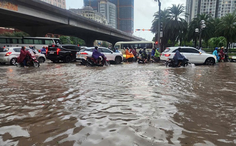
On land, it is forecasted that from the evening of August 26 to noon of August 27, the midlands and deltas of the North, Son La, Lao Cai, and Thanh Hoa will have moderate rain, heavy rain and thunderstorms, with common rainfall of 50-100mm, locally very heavy rain over 200mm.
In the evening and night of August 26, other places in the North will have rain, moderate rain and scattered thunderstorms with an amount of 20-40mm, locally over 100mm. From the afternoon of August 27, heavy rain in the Northern region will gradually decrease.
Nghe An to Ha Tinh, Central Highlands and Southern regions will have showers and thunderstorms, with common rainfall of 10-30mm, locally heavy rain over 70mm.
Due to the impact of low pressure and thunderstorms from the circulation of storm No. 5, tourists who go on tours to the island, take a cruise ship or participate in activities at sea need to closely monitor forecast information, follow the instructions of authorities and consider adjusting their schedules to ensure safety.
Be careful during thunderstorms with the possibility of tornadoes, lightning, hail and strong gusts of wind. Heavy rain is likely to cause flooding in low-lying areas, urban areas, industrial parks; flash floods on small rivers and streams; landslides on steep slopes.


