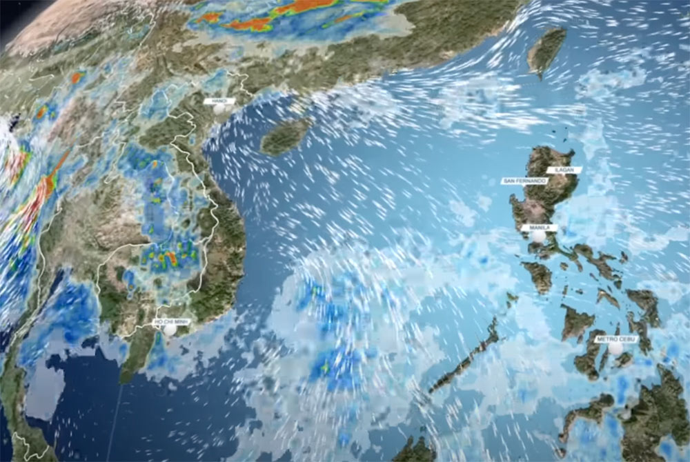
The low pressure area (temporarily identified as 91W Invest) is being monitored by the US Joint Typhoon Warning Center (JTWC).
The location of the low pressure area is determined to be southeast of Palawan Island (Philippines), about 200 km east of Truong Sa archipelago of Vietnam.
The low pressure is likely to cause landslides in many areas, affecting the weather in Vietnam from May 27 to 28.
Scattered tropical showers accompanied by strong winds of 15-25 km/h and rough seas are expected to occur on May 25 and 26 across Luzon, Visayas, Mindanao, Manila... of the Philippines.
Mr. Robert Speta, an American meteorologist at the US Navy's Jacksonville Naval Station (NAS Jacksonville), said that the low pressure area 91W is expected to affect some areas of Vietnam.
The easterly winds and the 91W area caused flooding in the Cagayan de Oro River area, northern Mindanao (Philippines), with heavy rain flooding streets and homes. In Henan Province (China), low troughs are also causing heavy rain, Speta said.
The forecast for continued heavy rainfall in the Bay of Bengal - some places could reach 500 to 1,000mm, which is extremely severe. On May 27, the winter wind will still prevail.
According to the National Center for Hydro-Meteorological Forecasting, on the morning of May 26, the Gulf of Tonkin had strong northeast winds of level 6, gusting to level 8. The sea area from Quang Tri to Quang Ngai, Binh Thuan to Ca Mau, the North and Central East Sea has had showers and thunderstorms.
In the North of the Gulf of Tonkin, in the North of the North East Sea, the Northeast wind will sometimes reach level 6, gusting to level 7-8, rough seas; waves 1.0-3.0m high.
Gulf of Tonkin, the sea area from Quang Tri to Quang Ngai, Binh Thuan to Ca Mau, Ca Mau to Kien Giang, the Gulf of Thailand, the East Sea area (including the sea areas of Hoang Sa archipelago and Truong Sa) will have showers and thunderstorms. During thunderstorms, there is a possibility of tornadoes, strong gusts of wind of level 6-7 and waves over 2.0m high.
Warning on the night of May 26 and May 27, the wind in the northern Gulf of Tonkin, the northern sea area of the North East Sea will gradually decrease.
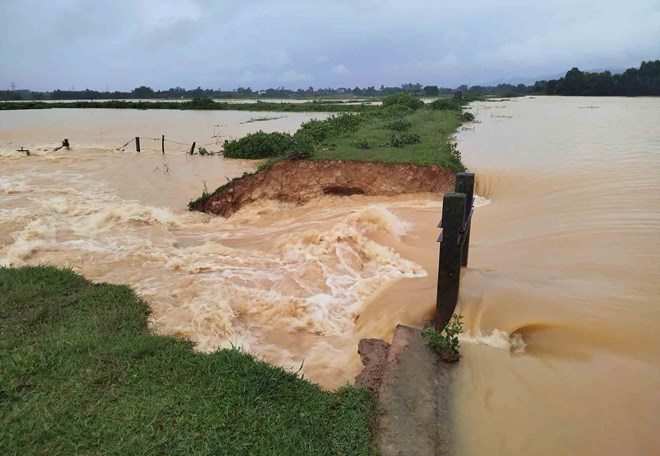
On May 26, South Nghe An to Quang Binh had moderate rain, heavy rain and thunderstorms, locally very heavy rain with common rainfall of 20-50mm, locally over 100mm.
On the day and night of May 26, Quang Tri to Quang Ngai will have scattered showers and thunderstorms, locally heavy rain with rainfall from 10-30mm, some places over 50mm.
In the afternoon and evening of May 26, the South will have scattered showers and thunderstorms, locally heavy rain with rainfall from 10-30mm, some places over 50mm.
Given the current weather situation, tourists need to proactively monitor weather forecasts regularly through meteorological agencies, weather apps or local news channels. Avoid outdoor activities such as swimming, sea sports, mountain climbing or forest trekking in affected areas.
Waves can be high and dangerous for small boats. If you plan to go to the islands, you should postpone or carefully check the weather conditions. If you have a tour, ask your travel agency about alternative options in case of bad weather.

