Although the roles of the 4 points are equal, however, by some coincidence, the 4 poles are divided into 2 pairs North - South and East - West which have completely opposite characteristics.
North - South is gentle, East - West is dangerous; North - South is smooth, East - West is harsh; North - South is easy, East - West is difficult. So we know, when Kim Dung created "Five Martial Arts Masters", it was not for no reason that he arranged Nam De - Bac Cai as a pair, Dong Ta - Tay Doc as a couple.
AN IMPOSSIBLE "TURN-OVER"
With the current good and modern road conditions, we can easily travel from Lung Cu to Ca Mau Cape, where the two northern and southern poles of Vietnam are located. However, to reach the Eastern Pole, put all those easy thoughts aside and prepare yourself for a torture.
Even accepting the hardship may not be enough, because fate is still needed to hope for a successful visit to the Easternmost point in terms of safety, smooth journey and weather, and especially for those who want to admire the glorious sunrise in this land furthest to the East.
After many times of being unlucky with the Far East, by chance the opportunity came in an unexpected way. The wandering took off like the wind, creating the infamous "encounters and battles". The original purpose was to fly to Cam Ranh and then catch a bus to Ninh Thuan to celebrate the Kate Festival of the Cham people, however, as soon as I got off the plane, I met an old friend.
By chance we met in the land of "Khanh Hoa tigers, Binh Thuan ghosts", after asking a few formal questions and hearing about the plan, I quickly "changed the direction" of the journey, instead of entering the land of "Hoi and Hoi ghosts" to go back to Co Ma pass to find the way to the East Pole and pay homage to the place where the first rays of the morning sun touched the land.
Three guys who used to play on the same forum, 1 visitor - 2 locals quickly consulted, made a few phone calls and quickly set off. It was around 3pm, needed to travel about 100km by motorbike to get to the destination. Very urgent, no preparation, exactly the meaning of "encountered battle".
The road from Nha Trang to Van Ninh was scorching hot, but at around 5:30 p.m., the group stopped at a fish noodle shop to quickly grab two bowls of delicious, green, chive-colored soup. Eating two bowls at once was partly because I had the habit of grabbing energy whenever I had a chance, in case I ran out of food in the middle of nowhere. On the other hand, the bowl of noodle soup was tiny, and it was gone in three hours.
After a short nap, the Tam Tam group played cards again. After a few more kilometers, just as they saw the top of Co Ma Pass, they turned right towards Van Phong Bay. The jet-black road painted in golden yellow was as beautiful as a silk strip winding between the sand dunes, sometimes yellow, sometimes white.
Then suddenly the road disappeared, leaving behind a bewildered, doubtful mind about the impermanence of the universe (or the feasibility of the suspended project). But whatever, the end of the road also means approaching the first leg of the journey: Dam Mon Market. From here, vehicles are left behind, the journey will proceed on foot.
When we arrived at Dam Mon market, it was already dark, and the group had just met up with a few other backpackers who had arrived earlier and were waiting for us. Going to the Far East, we needed a "native" to guide us and take care of basic logistics, so "small, disorganized" people like us often had to form teams.
The “native” brothers gathered, exchanged instructions, and then all set off together, cutting through the forest and crossing the desert to reach the finish line by 4:30 tomorrow morning. It was imperative to reach the finish line earlier or at the right time, because if it was later, “all we had left was our belts”, and there would be no more morning light or glorious dawn. Let’s go!

JOURNEY TO FIND THE SUN GOD
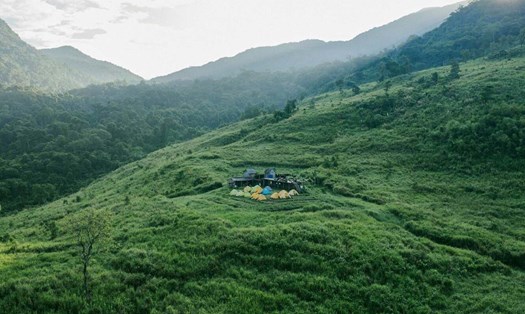
We put down some luggage, brought some water, and started our journey. After only a few dozen meters, the last stray light was turned off, leaving behind a white space thanks to the color of sand, the dark of the poplar trees, wild pineapples, and the endless light of the new moon past the full moon. We would have to travel about 7-8km, within 8 hours.
It was not easy because 90% of the terrain was desert and the remaining 10% was forest. The challenge was quicksand and 3 steep slopes, draining all our strength and excitement. On that journey, we only had one resting place, “Uncle Hai’s tent”, marked on the map as if searching for treasure.
After only about the first 500 meters, I felt my seven orifices panting, thirsty even though it was night and not scorched by the sun, and refused to communicate. Actually, even if I wanted to talk, I couldn’t. I could only follow the guide, trying to regulate my breathing and pace in a “qui tuc” manner.
And then, after about 2 hours of walking, the heart and lungs were working in harmony with the legs, the ears stopped ringing, and the noses and mouths took turns breathing. There were occasional exchanges of words, but everyone kept walking, ignoring the sand getting into their shoes and the pineapple thorns rubbing against their thighs and arms.
It was about 2:30 when we arrived at “Uncle Hai’s house” - a hut in the middle of the wild pineapple area. The sky was full of stars but the sky was pale. We quickly set off again to avoid missing a beat. From here, the road went downhill instead of uphill because we were about to reach the coast. Through the low forest canopy, we could see the hidden coves like Bai Na and Bai Mieu.
We walked with our heads down in the early crowing of jungle fowls, filled with fear because nothing comes as fast as the dawn at sea. Luckily, when we arrived at Bai Rang with hundreds of rocks as big as buffalos and elephants lying around, the clock was only 4 o'clock. We left our backpacks behind, only took our cameras and water bottles to find Mui Doi.
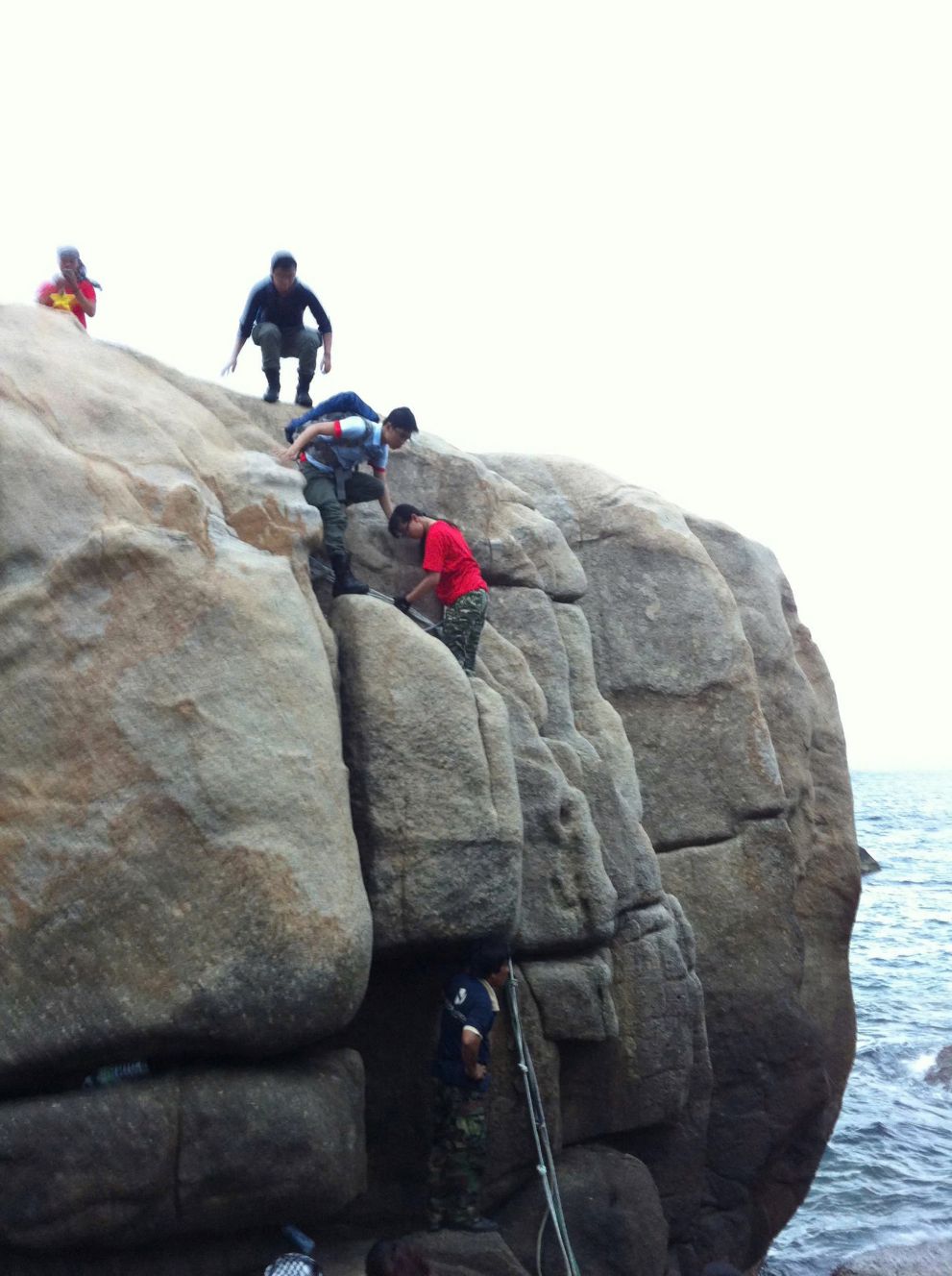
It was another arduous journey. We had to climb the elephant-backed rocks, move and jump to other rocks in the dim light of dawn. After about 30 minutes of climbing, the group approached the top of Mui Doi. To reach the top of this rock, we had to overcome a slippery cliff of about 3 meters, using only a coil of rope with a knot.
And the last bit of courage helped me set foot on the top of Mui Doi, the geographical piece - attached to the mainland - that extends the furthest to the East to form the easternmost tip of the Fatherland. This is the place where the mainland extends the furthest to the East, to the East Sea, not Mui Dien in Dai Lanh (Phu Yen).
Even now, many people have mistakenly thought that Mui Dien is the Easternmost point because the Vietnam Tourism Directorate, in March 2005, recognized Mui Dien (109o27'55" East longitude) as a national scenic spot, the Easternmost point on the mainland of Vietnam.
This has made Mui Dien the Easternmost point, because there is an “official document” and the journey to Mui Dien can be by car, especially after the Deo Ca tunnel was completed in 2017. However, for geographers and backpackers conquering “4 Poles, 1 Peak, 1 Fork”, Mui Doi is the Easternmost point, the place that welcomes the sunrise 0.4 seconds earlier than Mui Dien.
We reached the top and the last fragments of darkness melted into the waves. The joy of self-conquest flowed down our faces as the warm dawn beamed over the silver waves. It was a reward that filled our mind, body, and spirit with blissful emotions.
I looked down and saw that the clock read 5:15. The fire crow had left the horizon to circle over the blue sea, lighting up the whole universe. The sunlight sparkled on the stainless steel top engraved with the name Mui Doi and the coordinates 12o38'39" North latitude - 109o27'50" East longitude. Here, the easternmost point of our beloved Fatherland!


