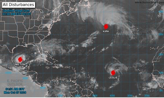
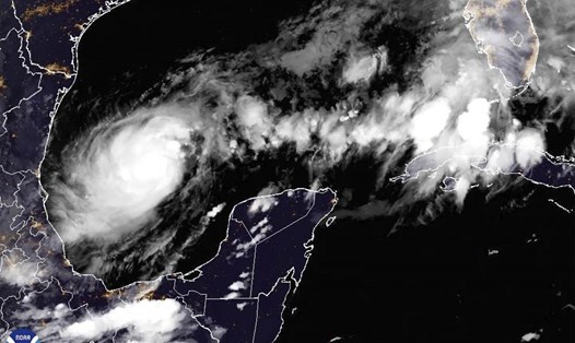
The US National Hurricane Center (NHC) said in a bulletin on the morning of October 8 that Hurricane Milton had strengthened to a Category 5 storm with maximum sustained winds of 265 km/h on the night of October 8 (local time). It will continue to move through Florida this week.
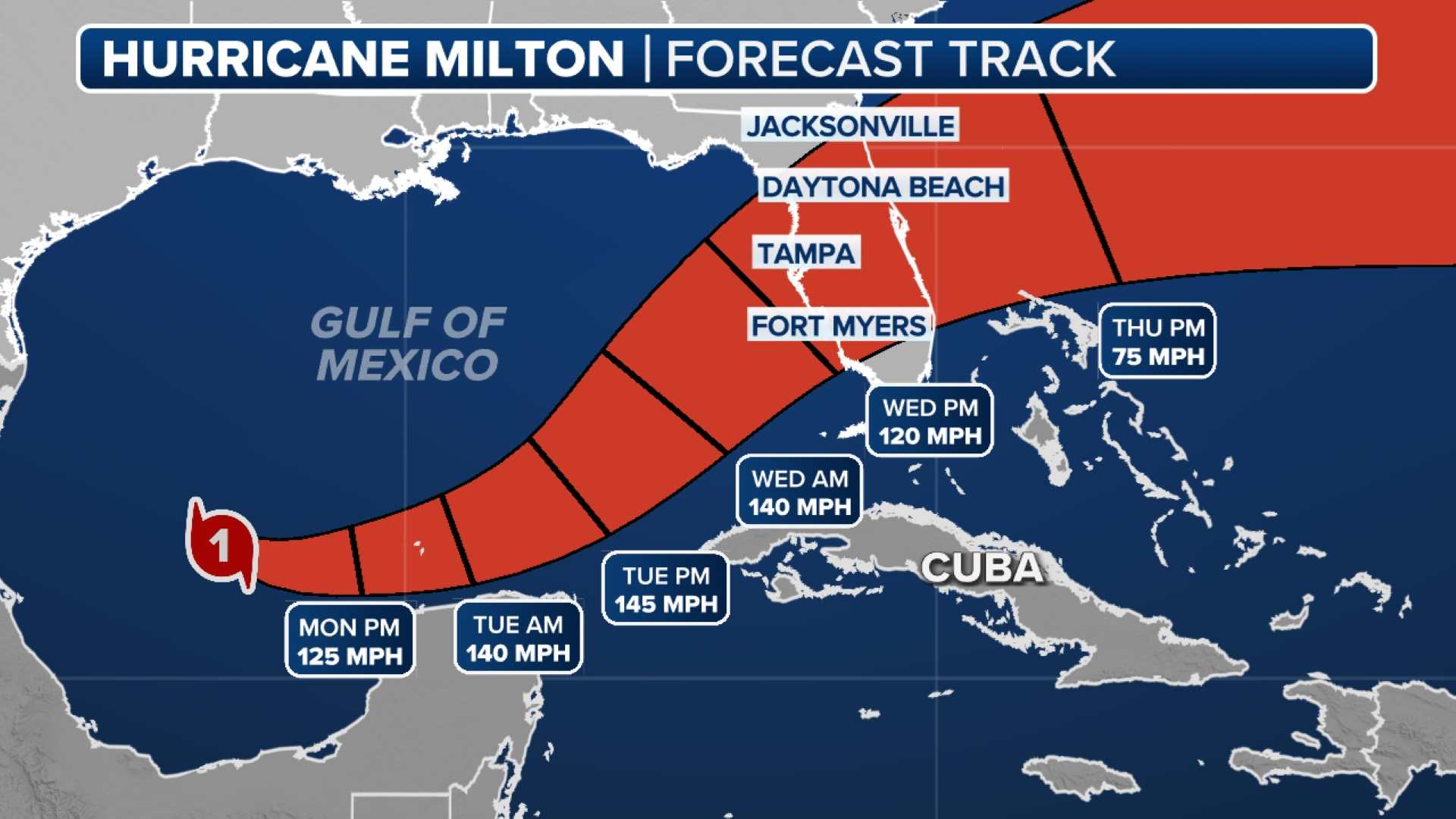
The NHC warned that the storm would pass over Mexico’s Yucatan Peninsula. The center of the storm was about 650 miles southwest of Tampa late on Oct. 8, moving east at 9 mph.

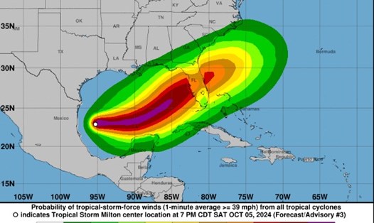
Florida’s Gulf Coast will be bracing for the Category 5 storm. Milton’s eye could make landfall on October 9 in the Tampa Bay area, which hasn’t been directly impacted by a major hurricane in more than a century. The Tampa metropolitan area has a population of more than 3.3 million.
Scientists predict the storm will weaken slightly before making landfall, but it will maintain the strength of a major hurricane as it moves across central Florida toward the Atlantic.
Fortunately, this path will avoid much of the state that was devastated by Hurricane Helene, which killed at least 230 people as it made its way from Florida to the Carolinas.
Evacuation orders have been issued ahead of Milton's landfall. A storm surge of 8 to 12 feet is expected in Tampa Bay, the highest ever predicted for the area and nearly double the level reached two weeks ago during Hurricane Helene.
The storm could also cause widespread flooding. Rainfall amounts of 130 to 250mm are expected across mainland Florida and the Keys, with up to 380mm in some places.
Hillsborough County, part of Tampa, has ordered evacuations of areas bordering Tampa Bay. According to AP, 7,000 law enforcement personnel have been mobilized to prepare for the response, marking one of the largest federal mobilizations in history.
Milton is an unpredictable storm that could make landfall with multiple threats. If you have plans to travel to these areas this week, consider postponing your travel and actively monitor weather forecasts and warnings from local authorities.


