According to the National Center for Hydro-Meteorological Forecasting, around early morning and early morning of February 7, this cold air mass will affect the Northeast region, then affect the Northwest region, North Central region, Central Central region and some places in the South Central region. Northeast wind inland will strengthen to level 3, coastal areas level 3-4, some places will have gusts of level 6.
In the North, from the afternoon of February 7, the weather will turn cold and very cold. From the night of February 7, the weather will turn cold in the North Central region, the area from Quang Binh to Hue will turn cold, some places will be very cold. The lowest temperature in this cold air mass in the North is generally 9-12 degrees, in mountainous areas 5-8 degrees, in high mountainous areas below 2 degrees in some places; in the North Central region, it is generally 11-14 degrees, in the area from Quang Binh to Hue, it is generally 14-16 degrees.
In Hanoi, from the afternoon of February 7, the weather turned cold, with some places experiencing severe cold. The lowest temperature in this cold air mass is commonly 10-12 degrees.
From February 7, in the Gulf of Tonkin, the Northeast wind is strong at level 6, sometimes level 7, gusting to level 8-9, rough seas, waves 2.0-3.0m high. In the North East Sea (including the Hoang Sa archipelago), the Northeast wind is strong at level 6, then increasing to level 7, gusting to level 9, rough seas, waves 4.0-6.0m high.

From the afternoon of February 7, the sea area from Quang Tri to Ca Mau, the area between the East Sea and the western sea area of the South East Sea (including the sea area west of Truong Sa archipelago) will gradually increase to level 6, sometimes level 7, gusting to level 8-9, rough seas, waves 4.0-6.0m high.From the night of February 7, the sea area east of the South East Sea (including the sea area east of Truong Sa archipelago) will gradually increase to level 6, gusting to level 7-8, rough seas, waves 3.0-5.0m high.
The widespread cold spell in the North and the North Central provinces is likely to last until around February 10.Due to the influence of the strengthening cold air combined with the strong currents in the upper westerly wind zone, from the night of February 6 to the morning of February 8, the North and Thanh Hoa regions will have scattered rain.From February 7-9, the area from Nghe An to Khanh Hoa will have rain, showers, locally heavy rain and thunderstorms.
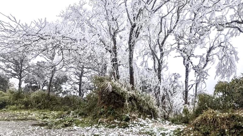
The mountainous areas of the North are likely to experience snow and ice. Thunderstorms are likely to produce tornadoes, lightning and strong gusts of wind.
Localized heavy rains can cause flooding in low-lying areas; flash floods in small rivers and streams, and landslides on steep slopes.
With these weather conditions, people and tourists should pay attention to weather forecasts, bring warm clothes and thermal clothing when traveling to the North and North Central regions. Bring raincoats and umbrellas when traveling to the North, Thanh Hoa, from Nghe An to Khanh Hoa to prevent rain.


