The weather in the North has changed very quickly since the evening of August 5. Mr. Nguyen Van Huong - Head of Weather Forecasting Department, National Center for Hydro-Meteorological Forecasting, gave assessments of weather developments in recent days and upcoming forecasts.

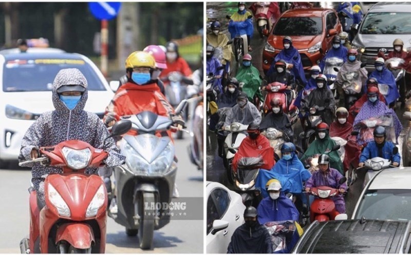
Sir, the Northern Delta has just experienced record-breaking sunny days in August. Is the recent severe heat unusual?
- From August 2 to 4, hot and severe heat will occur widely in the Northern and Central regions. This heat wave has the highest temperature in the Northern region, concentrated in the midlands and deltas of the North with the peak of the heat wave on August 3 and 4.
The highest temperature is generally from 38 - 40 degrees Celsius, some places above 40 degrees Celsius such as Lang (Hanoi) are 40.3 degrees Celsius, Phu Ly (Ninh Binh) is 40.2 degrees Celsius (while in the Central region, the highest temperature is only generally from 36-38 degrees Celsius, some places are approximately 39 degrees Celsius).
According to statistics in the Northern region, there have been 20 meteorological stations that have recorded the highest temperature value of the day exceeding the previous historical value observed in the same period in August.
Although the temperature recorded during this heat wave is not the highest level ever recorded in the summer in the North (usually in June or July). However, compared to the same period in August of previous years, this is still a rare temperature.
Currently, the North is experiencing thunderstorms to cool down, after this rain, will the hot weather pattern return or not, sir?
- It is forecasted that from now until August 7, the Northern provinces will experience a widespread thunderstorm, in which the midlands and mountainous areas are likely to experience moderate to heavy rain, some places have very heavy rain.
It is forecasted that from around August 8 to 11, the hot weather in the North is likely to return. For the Central provinces, the hot weather will continue and is likely to end around August 11 - 12.
After a long series of hot days, what dangerous phenomena will thunderstorms bring about? Please give your comments and warnings so that people can take timely precautions?
- During the rain period from now until August 7 in the North, we pay special attention to rain with high intensity that is likely to appear. Therefore, in the coming days in the northern mountainous region, it is necessary to pay close attention to the risk of flash floods and landslides.
In addition, it is also worth noting that after prolonged days of severe heat in Hanoi and many northern provinces and cities, the air in the low-rise has become very hot and accumulates great energy.
When thunderstorms appear, this condition can easily lead to the formation and strong development of convective cloud pockets, causing strong thunderstorms accompanied by tornadoes, lightning, hail and strong gusts of wind in the evening.
These dangerous weather phenomena often occur in a short time but are very intense, and can cause great damage to people and property if timely precautions are not taken.
Therefore, for the risk of flash floods and landslides; people, especially local people in the northern mountainous areas, need to have a good grasp of the terrain of their residence, combined with information received from hydrometeorological agencies to have solutions to ensure safety for themselves and those around them.
For example, when there is heavy rain, regularly observe phenomena that occur around such as cracks in soil, rocks, changes in river water (color, water level)... to promptly detect the risk of floods, flash floods, landslides, and take shelter to a safe place.
As for the risk of thunderstorms, whirlwinds, and strong gusts of wind, during thunderstorms, people need to limit going out when there are signs of black clouds, strong winds, and thunderstorms; proactively put up against houses and signs, especially in vacant, high-rise areas, where strong gusts of wind are likely to hit.
Drivers should stop at a safe place if there is a thunderstorm, avoid going through flooded roads and areas with the potential for landslides.
We recommend that people regularly monitor updated weather forecasts and warnings from the National Center for Hydro-Meteorological Forecasting to promptly respond.
Sincerely thank you!