According to the latest storm forecast on December 2 of the Philippine Atmospheric, Geophysical and Astronomical Services Administration (PAGASA), the new low pressure is very likely to become a storm near the Philippines and enter the East Sea, with the area of influence in the East Sea quite similar to storm No. 15 Koto.
The bulletin said that the low pressure currently operating at the eastern boundary of the TCAD forecast area will enter the Philippine Forecast Area (PAR), passing through the Dinagat - Visayas - Southern Luzon region of the Philippines.
Notably, Philippine typhoon forecasters said that this low pressure has a high probability of strengthening into a storm. When it strengthens into a storm, this system will become the 23rd storm Wilma of the Philippines. This will be the first storm to hit the Philippines in December.
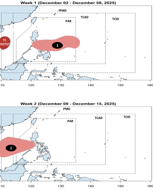
According to the forecast, potential storm Wilma will pass through Mindoro - Northern Palawan of the Philippines before entering the East Sea during the week of December 9 to December 15. According to PAGASA's forecast, storm No. 16 in the East Sea has an area of influence quite similar to the influence of storm No. 15 Koto in the East Sea.
Previously, PAGASA's storm bulletin on the morning of December 2 said that low pressure 12a near the Philippines is likely to become a tropical depression within the next 24 to 48 hours and enter PAR on the morning of December 3. PAGASA weather forecaster Charmagne Varilla said that this potential storm could make landfall in Eastern Visayas and Caraga from the night of December 7 to the morning of December 9, causing rain in Southern Luzon, Visayas and Northern Mindanao.


