The Hong Kong Observatory (China) issued a Category 10 storm warning signal at 9:20 a.m. on July 20 (local time), after Typhoon Wipha strengthened into a high-level tropical storm just before midnight. This is the highest warning level, showing that the city is facing the risk of average gusts of wind of 118 km/h or more.
Typhoon Wipha is forecast to pass about 50 km south of Hong Kong (China) at noon the same day, posing a significant threat to the area. Previously, at 7:20 a.m., a level 9 warning signal was issued, just 7 hours after the first No. 8 warning of the year was issued. Bad weather with heavy rain and strong gusts of wind is expected to last for a long time.
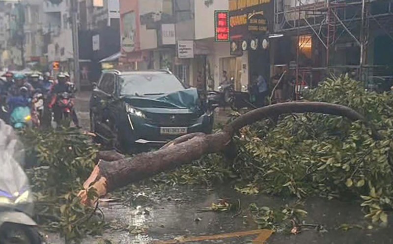
Up to now, there has been one case of one person injured by the storm, along with two cases of fallen trees. A total of 198 people have sought shelter in centers run by the Hong Kong government. The last time the city issued a storm signal was during super typhoon Saola in 2023, when 86 people were injured, landslides occurred and thousands of trees were uprooted.
Due to the complicated storm situation, more than 500 flights were canceled on weekends. However, the Airport Management Agency said about 400 flights could resume operations on the afternoon of July 20, as the storm moves away. The airport is expected to be very crowded in the evening to serve the travel of about 100,000 passengers.
In China, the National Meteorological Center continues to issue an orange warning and said that Typhoon Wipha is likely to intensify and make landfall in the afternoon or evening of the same day. The storm is forecast to affect the coastal area between Chau Hai and Tram Giang, Quang Dong province, with the strength of a storm or strong storm.
In the whole of Quang Dong province, more than 278,000 people have been evacuated to safety. In Chau Hai and Duong Giang, local authorities have applied a "year of suspension" order including: stopping studying, stopping work, stopping production, stopping public transport and stopping business.