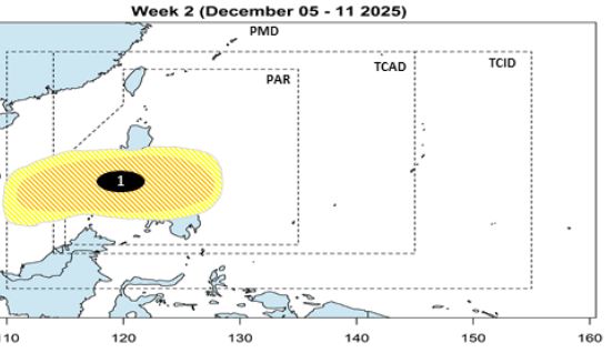
Typhoon forecast models are monitoring a new disturbance zone outside the Philippine Forecast Area (PAR), which is likely to develop into a tropical depression and strengthen into Typhoon Wilma in early December.
Based on the modern atmospheric dynamic model FV3 of the US National Oceanic and Atmospheric Administration (NOAA), one of the earliest scenarios shows that the low pressure may approach Northern Mindanao - Eastern Visayas - the Bicol region of the Philippines.
There are currently two main scenarios: First, moving west-northwest, then possibly away from the Philippines. Second, go straight to the west, thereby affecting the eastern part of the Philippines.
The storm forecast of the Philippine Atmospheric, Geophysical and Astronomical Services Administration (PAGASA) on November 28 also said that during the week from November 28 to December 4, the low pressure is expected to appear far east of the Philippines, moving west, entering PAR. If it strengthens into a storm, the storm will be named Wilma - the 23rd storm to operate in the PAR this year.
PAGASA assessed the possibility of this low pressure area strengthening into a storm during the week of November 28-4-12, at a low to moderate level. PAGASA's forecast model is currently leaning towards the system's ability to approach Eastern Visayas and Bicol.
In the week of December 5-11, the low pressure is still likely to strengthen into a low to moderate storm, possibly making landfall in Northern Mindanao - Visayas - Southern Luzon and entering the East Sea.

Regarding storm No. 15, this storm will gradually weaken in the coming days. According to the storm forecast of the National Center for Hydro-Meteorological Forecasting through Vietnam, by 1:00 p.m. on November 29, the storm will be in the western sea area of the central East Sea, with the intensity reduced to level 9-10, gusting to level 13.
At 1:00 p.m. on November 30, the storm continued to move north-northwest at 3-5km/h, about 280km east of the eastern coast of Gia Lai province. The intensity of weakness is level 9, gust level 12.
Notably, at 1:00 p.m. on December 1, the storm turned west-southwest, 3-5km/h, about 200km east of Gia Lai coast, with continued weakening, reaching level 8-9, gusting to level 12. From the next 72 to 120 hours, the storm will move slowly in the west-southwest direction at a speed of about 5km/h and continue to weaken.
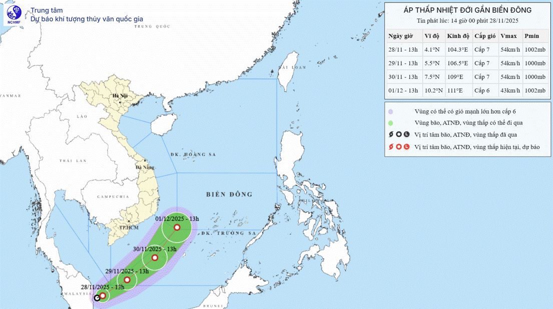
Meanwhile, on November 29, a tropical depression is active in the southwestern sea area of the southern East Sea, strong at level 7, gusting to level 9, moving northeast, about 15 km/h, likely to enter the southwestern sea area of the southern East Sea.

From the next 48 to 72 hours, the tropical depression will move mainly in the north-northeast direction, traveling about 15km per hour, gradually weakening in intensity.
Notably, the tropical depression weakened from Typhoon Senyar - considered an unprecedented storm in the history of more than 180 years. The first tropical storm in more than 180 years to form in the Strait of Malacca, an area considered to be without a storm.
Although Senyar weakened into a tropical depression, the city system was dragged east, a phenomenon that was first recorded between the two climate basins of the Indian Ocean and the Northwest Pacific.


