1.2km long riverbank landslide
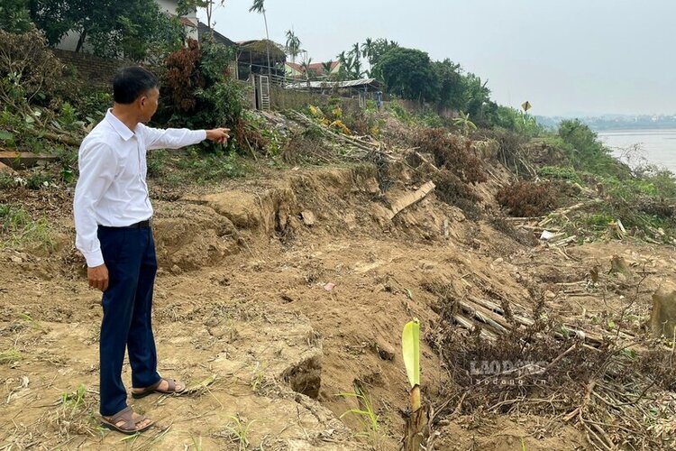
According to the reporter of Lao Dong Newspaper in mid-July, the left bank of Thao River (Red River) passing through Lam Thao Commune, Phu Tho Province (Thach Son Commune, the old Lam Thao District) has suffered serious landslides.
According to observations, at this time, when floodwaters from upstream poured in, the Red River water here was muddy, carrying a lot of mud, trees... the mainstream on the left bank of the river approached Lam Thao commune, the water flowed more strongly on the opposite side, with some places even having tornadoes.
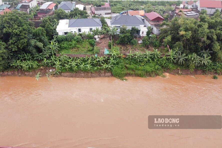
It can be seen that the landslide is very long, many areas of land and crops of the people have flowed with the strong water, some landslides are less than 10m from the fence of the house.
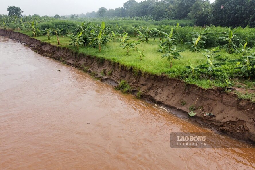
According to the report of Lam Thao Commune People's Committee, from Km72 - Km73+200, there was a riverbank landslide with a length of about 1.2km and an average width of about 40m.
In particular, the most serious is the section from Km72+800 to Km73+100, where there were deep tornadoes and landslides about 60 m of alluvial plain, eating deep to the foot of the embankment, only 8 - 10 m from the top of the embankment, the risk of landslides continued to develop complicatedly, seriously affecting the safety of people's lives, property and agricultural production activities.
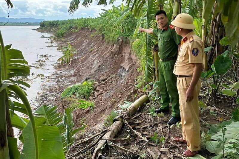
In the face of the above situation, Lam Thao Commune People's Committee has directed residential areas along the dike to strengthen monitoring, grasp the landslide situation, isolate dangerous areas, regularly inspect, promptly report to the Commune People's Committee for appropriate response measures to ensure safety.
Along with that, strengthen propaganda and mobilize people not to graze cattle, not to enter areas at high risk of subsidence and landslides.
Lam Thao Commune People's Committee also recommended that competent authorities soon have a plan to handle and reinforce the embankment in areas that have not been solidified to minimize damage, protect people's lives and production.
Unstable riverbank section
As Lao Dong has reported in many articles, the left bank of the Red River through the old Lam Thao district often experiences landslides, causing many damages to property and crops, threatening the safety of households. After that, the state had to invest billions of VND to handle the emergency.
Most recently, in August 2024, riverbank landslides occurred in Ban Nguyen commune, the old Lam Thao district (now Ban Nguyen commune) with a length of about 250m, about 10m wide, and about 80m from people's houses.
At that time, the Department of Agriculture and Rural Development of Phu Tho province (now the Department of Agriculture and Environment) implemented a project to urgently handle incidents of riverbank, riverbank and embankment landslides in Ban Nguyen, respectively from Km84+500 - Km85 and Km87 - Km89+200 of the left dike of Thao River, in Ban Nguyen commune, Lam Thao district (total investment of 75 billion VND).
More seriously, in November 2023, a section of the left dike of the river about 1km long through Phung Nguyen commune, the old Lam Thao district (now Phung Nguyen commune) suffered a landslide, the embankment foot was deeply eroded, the embankment top appeared slippery. In particular, the landslide at Km79+350 - Km79+500 is only a few meters from National Highway 2D.
The landslide situation directly threatened the property and lives of 7 households. Of which, 2 households had serious cracks, causing local authorities and people in the area to support the emergency evacuation of people and property to a safe place.
After that, the Ministry of Agriculture and Rural Development (now the Ministry of Agriculture and Environment) conducted a survey, thereby deciding to support 20 billion VND from the urgent budget for handling dyke incidents managed by the Ministry for Phu Tho province to handle landslides. By early 2024, the embankment line had been completed and handed over for use.