Cao Bang suddenly has heavy rain and thunderstorms even though storm Wipha has just entered the East Sea

Tân Văn |

Cao Bang - During the 20 minutes of thunderstorms and heavy rain, many damages were caused to the locality.

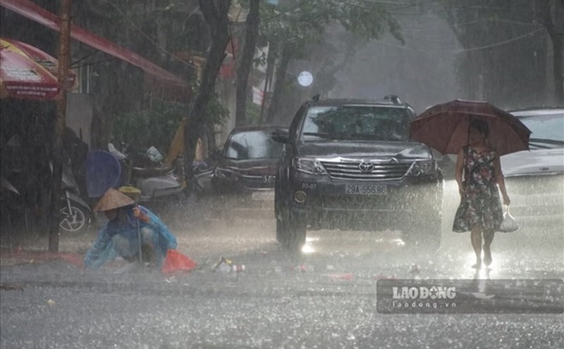
According to the reporter's records, at around 1:00 p.m. on July 19, in Cao Bang, the weather started to increase with strong winds and black clouds. After 20 minutes of strong winds, the rain started, and by 1:50 p.m. it had stopped.

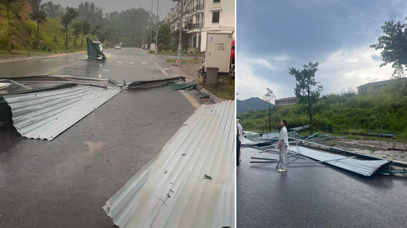
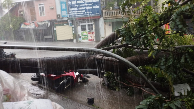
Although it occurred in a short time, many extreme weather phenomena appeared. In Hoa An commune and Thuc Phan ward and some places, there will be light rain and hail.

In many places, many trees fell due to heavy rain. In particular, there were cases where fallen trees hit a motorbike, and the corrugated iron roofs of households were blown away by the wind.

Xuat hien mua da va nhieu cay xanh bi nga do sau mua. Anh: Tan Van
Snows appeared and many trees fell after the rain. Photo: Tan Van

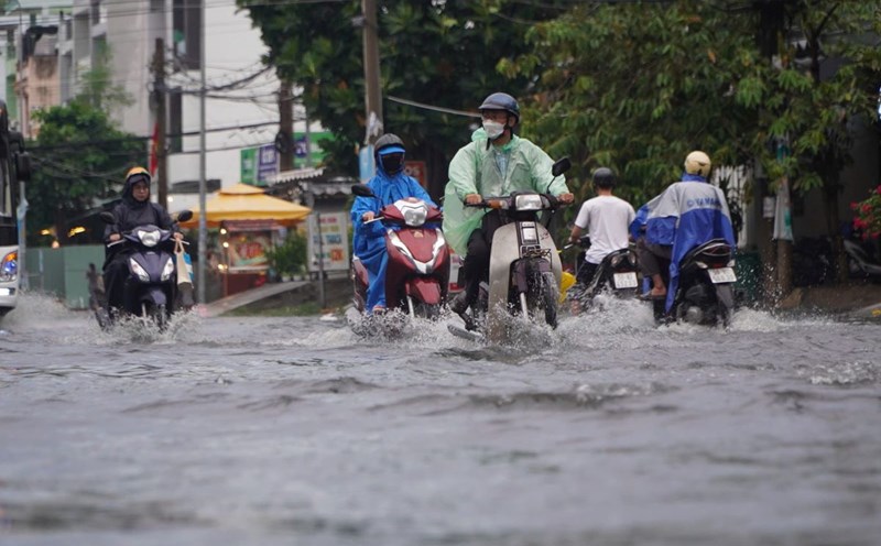
Although not directly affected by storm No. 3 (Wipha), Cao Bang province has just experienced heavy rain with strong gusts of wind, so people need to be very cautious and regularly monitor the weather situation.

According to the forecast, the most dangerous in the next 24 hours is strong winds and big waves in the northern and central areas of the East Sea (the sea area of Hoang Sa special zone); the northern sea area of the North East Sea is where the storm passes, with wind intensity of level 10 - 12, gusts of level 15, waves 3 - 5m high, the area near the storm's center 4 - 6m.

From around July 20 to 21, the special areas of Bach Long Vi, Co To, Cat Hai... are likely to be greatly affected by strong winds and heavy rain due to storm No. 3.

Nhung tam ton bi gio thoi bay. Anh: Bach Diep
The corrugated iron sheets were blown away by the wind. Photo: Bach Diep

Around early morning and on July 22, the storm affected our mainland. The coastal waters from Quang Ninh to Thanh Hoa will begin to be directly affected by strong winds, heavy rain and rising water with strong winds of level 7 - 9, waves 3 - 5m high.

Mot chiec xe may bi cay xanh do, de trung trong mua lon. Anh: Ha Cuong
A motorbike was hit by a fallen tree in heavy rain. Photo: Ha Cuong

Typhoon Wipha is considered a strong storm, moving rapidly at a speed of about 20km/h. The circulation causes rain to shift to the South and the West. Therefore, thunderstorms before the storm may occur on July 20-21, when the storm is still outside the Gulf of Tonkin and east of the Lusian Peninsula (China).

Tân Văn
RELATED NEWS

Developments affecting storm No. 3 to rain in the Southern region

|

HCMC - According to the Southern and Central Highlands Hydrometeorological Station, there will be scattered showers and thunderstorms in the afternoon and evening.

Latest forecast of the time when Typhoon Wipha will cause heavy rain and strong winds in the North

|

According to the representative of the meteorological agency, with the current scenario, it is forecasted that around July 21, storm Wipha will begin to cause strong winds in the coastal area and widespread heavy rain in the North.

Forecast of when Typhoon Wipha will reach its strongest intensity, causing heavy rain on land

|

According to the representative of the meteorological agency, in the next 48 hours, Typhoon Wipha will reach its strongest intensity of about level 11 - 12 when it approaches the Lusian Peninsula (China).

9th Hour No. 188: When the Heart Goes Away - Part 1

|

Hour 9 - A happy family, the husband suddenly gets lost with a karaoke girl and secretly builds his own "home". Where will this marriage go?

Chairman of the Vietnam General Confederation of Labor presents 200 Tet gifts to workers in difficult circumstances in Dak Lak

|

Dak Lak - Chairman of the Vietnam General Confederation of Labor has presented 200 Tet gifts to union members and workers, contributing to helping them celebrate Tet more fully.

Hanoi Party Secretary inspects the construction progress of Hong Ha bridge

|

Politburo member, Secretary of the Hanoi Party Committee Nguyen Duy Ngoc highly appreciated the efforts of the forces working at the Hong Ha bridge construction site.

Prolonged congestion at the western gateway of Ho Chi Minh City

|

Ho Chi Minh City - In the afternoon of February 11, the flow of vehicles to the Mekong Delta increased sharply, causing prolonged congestion on some roads in the gateway area.

Bustling Tet atmosphere, Hanoi entertainment venues urgently welcome visitors at the beginning of the year

|

Hanoi - Near Tet, in public areas and entertainment venues of the Capital, decoration work is being urgently completed to welcome guests at the beginning of the year.

Developments affecting storm No. 3 to rain in the Southern region

HẠ MÂY |

HCMC - According to the Southern and Central Highlands Hydrometeorological Station, there will be scattered showers and thunderstorms in the afternoon and evening.

Latest forecast of the time when Typhoon Wipha will cause heavy rain and strong winds in the North

LINH ANH |

According to the representative of the meteorological agency, with the current scenario, it is forecasted that around July 21, storm Wipha will begin to cause strong winds in the coastal area and widespread heavy rain in the North.

Forecast of when Typhoon Wipha will reach its strongest intensity, causing heavy rain on land

AN AN |

According to the representative of the meteorological agency, in the next 48 hours, Typhoon Wipha will reach its strongest intensity of about level 11 - 12 when it approaches the Lusian Peninsula (China).