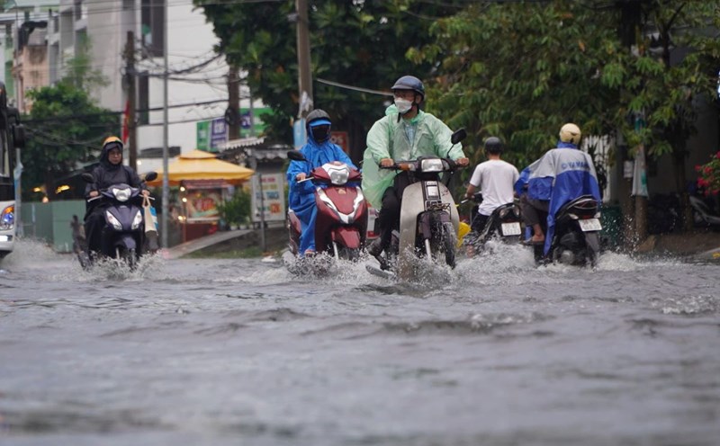
At noon on July 20, many areas in Ho Chi Minh City had heavy rain accompanied by strong winds, making it more difficult for people to move outdoors.
Through monitoring on satellite cloud images, weather radar images, and lightning positioning, convective clouds are developing strongly, causing showers and thunderstorms in Long Hoa commune and Con Dao Special Zone, the sea and island areas of Ho Chi Minh City. The cloud area will move from the West to the East.
In the period from now until the next 3 hours, thunderstorms will continue to develop, causing showers with thunderstorms and lightning in the above areas and Can Gio, the coastal area of Ho Chi Minh City.
In the next 1 to 3 hours, another cloud area in Tay Ninh province is moving towards Ho Chi Minh City, causing showers and thunderstorms in Dau Tieng, Minh Thanh areas... and thunderstorms tend to expand and spread to other neighboring areas of Ho Chi Minh City. Rainfall is generally from 15-25 mm, in some places over 30 mm.
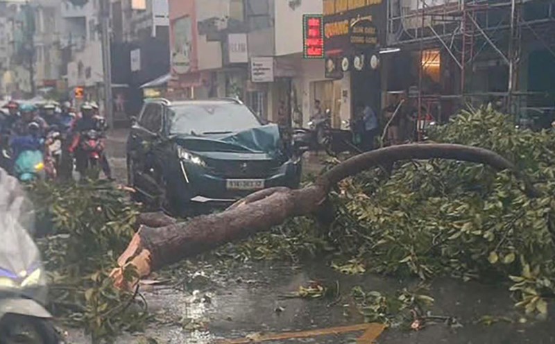
During thunderstorms, beware of tornadoes, lightning, hail, strong gusts of wind of level 5-8 (8-21 m/s) that break trees, damage houses, traffic works and infrastructure, endanger human life; heavy rain causing local flooding in low-lying areas.
All ships operating in the above sea areas are at high risk of being affected by tornadoes and strong winds.