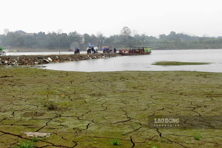
As reported, in recent months, the water level of the Red River and the Lo River passing through Phu Tho province has been low, with no bottom at all.
With the Red River, the water released huge sand dunes, many sections of the river flow were significantly narrowed, and the reporter even noted that people could walk in the middle of the river to fish.
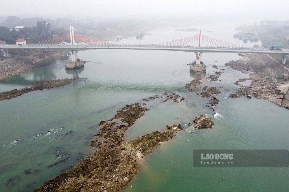
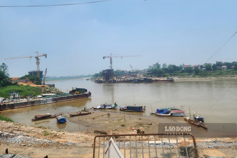
With the Lo River, the water released the reefs in the middle of the river, making waterway transportation difficult, and recording that some boats ran aground due to impact with the reefs.

According to the National Center for Hydro-Meteorological Forecasting's short-term hydrological forecast and warning bulletin on September 5, the water level of the Thao River (Red River) at Phu Tho station at 7:00 a.m. the same day was 10.81 m, the water level of the Lo River at Vu Quanh station (Doan Hung district, Phu Tho) was 4.84 m.
According to data from the forecasting newsletter, the long -term hydrological warning (from 1.5 to May 31), in May, the water level at the two rivers above is forecast to increase slightly in the first 20 days of the month, especially the Lo River water level is improved more clearly in the last 10 days of the month.
The newsletter stated, in the previous period (April), the water level of the Red River was measured at the average Phu Tho station of 10.95 m, the highest was 11.61 m, the lowest is 10.35 m. With the Lo River, the actual water level is measured at the average optical station of 4.66 m, the highest 5.13 m, the lowest 4.33 m.
According to the forecast, in May, the water level on the Red River continued to change slowly and there was a possibility of 1 wave of oscillation in the final period. The water level on the Lo River will continue to fluctuate according to the regulation of the upper hydroelectricity and tend to increase in the final period.
Red River water level at Phu Tho station is expected to increase slightly in the first 20 days of May; At the last 10 days of the month, the water level will improve, the average forecast is about 12.00 m, the highest can be 12.50 m, the lowest 11.50 m.
On average, the water level of the Red River at Phu Tho station is forecast to reach about 11.40 m, an increase of only nearly 50 cm compared to April, the situation of the Red River bank being at the bottom of the past months has not been ended.
Similar to the Red River, the water level of the Lo River at the Department of Quang is expected to increase slightly in the first 20 days of May; At the end of the month, the water level is forecast to increase, an average of 6.90 m, the highest can reach 7.50 m, the lowest 4.50 m.
On average, the water level of the Lo River at Vu Quang station is forecast to reach about 5.50 m, although it will only increase by nearly 1 m compared to April, however, in the last 10 days of the month, the water level of this river will improve significantly.
According to the monthly Water Forecast bulletin (from May 1 to May 31), in April, the total flow on Thao River at Yen Bai station was 54% lower than the average of many years in the same period, on Lo River at Tuyen Quang station was 63% lower (Phu Tho in the downstream).
It is forecasted that in May, the total flow on Thao River at Yen Bai station will be 48% lower than the average of many years in the same period, on Lo River at Tuyen Quang station will be 45% lower.