At 10:00 on July 20, the center of storm No. 3 was at about 21.8 degrees North latitude; 114.2 degrees East longitude, in the northern sea area of the North East Sea, about 680km east of Quang Ninh - Hai Phong. The strongest wind near the storm center is level 11-12, gusting to level 15. The storm is moving west at a speed of 20-25km/h.
The storm is forecast to continue moving westward, then turn west-southwest at a speed of 20-25km/h.
At 10:00 on July 21, in the eastern sea area of the Northern Gulf of Tonkin, the intensity was level 11, gusting to level 14. By 10:00 on July 22, the coastal areas of Quang Ninh - Thanh Hoa will have an intensity of level 10-11, gusting to level 14.
Warning from 21-23.7, the Northeast, Northern Delta, Thanh Hoa, Nghe An areas will have very heavy rain from 200 to 350mm, locally more than 600mm. Other places in the North and Ha Tinh will have rain from 100 to 200mm, locally more than 300mm.
Heavy rain is likely to cause flooding in low-lying areas; flash floods on small rivers and streams, landslides on steep slopes.
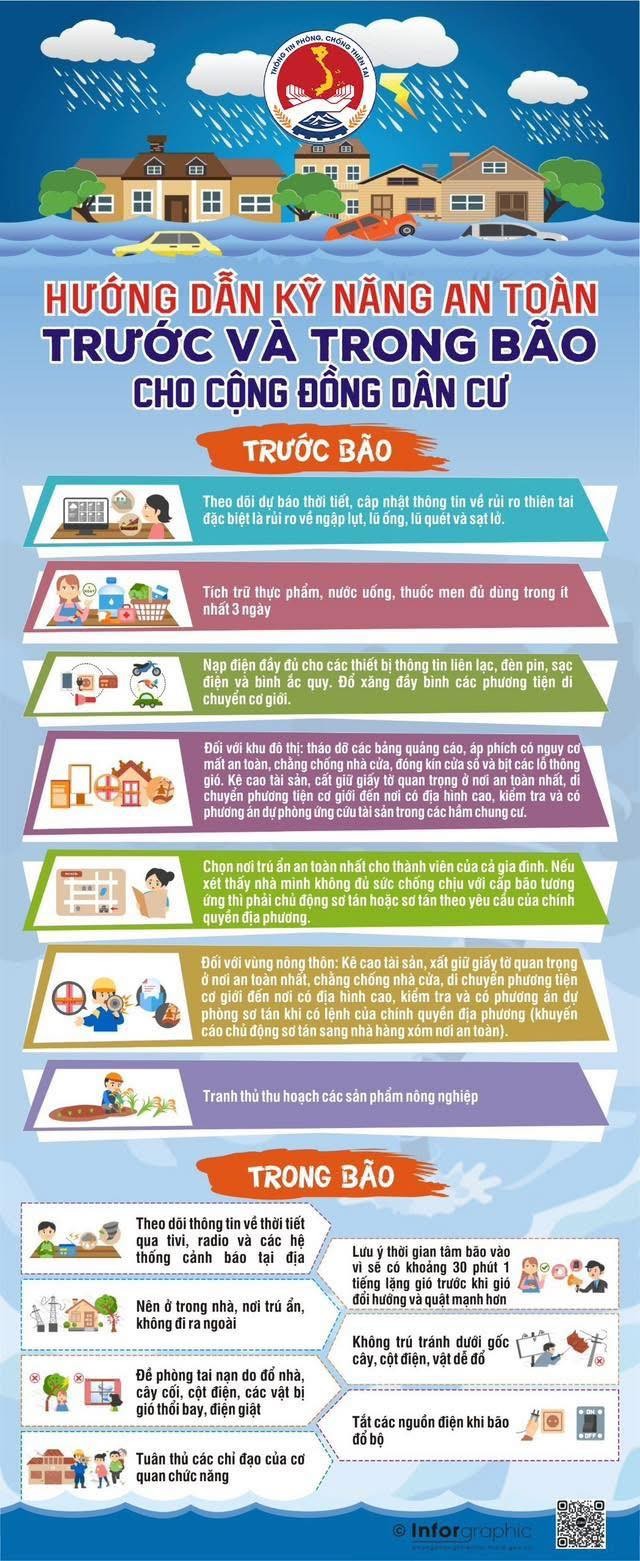
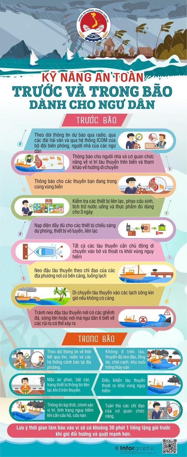
To ensure the safety of life and property before and after storms and floods, the Department of Dyke Management and Natural Disaster Prevention and Control recommends that people should not be subjective and follow the following recommendations:
• Monitor forecasts, warnings, and updates on storm developments to proactively prevent and avoid.
• Ensure safety of anchored boats, protect cages and aquaculture rafts, especially people on the islands; Absolutely do not stay on anchored boats, tourist boats, cages, cages, and aquaculture areas when the storm hits.
• Ensure safety when traveling during the rainy season: regularly monitor weather developments, warn of natural disasters, proactively postpone or cancel trips during bad weather to ensure safety; avoid traveling to coastal areas, islands, mountainous areas or areas at risk of landslides and flash floods. Absolutely do not go out when the storm is making landfall, except in emergency cases and with specific instructions from the authorities.
• Determine the safest shelter for all family members; proactively evacuate when necessary or at the request of local authorities.
• Proactively stock up on food, drinking water, medicine, and necessary items.
• reinforcing and not blocking houses; pruning tree branches; removing advertising signs and posters at risk of insecurity; ensuring the safety of construction works.
• Solidarate livestock and poultry barns; take advantage of early harvesting of agricultural and aquatic products according to the motto "greener at home than in the fields"
• Prevent rain, floods, and inundation in some low-lying areas, urban areas, flash floods, and landslides in mountainous areas; prevent rising water in coastal areas and river mouths.
• Raising assets, storing important documents in a safe place, moving motor vehicles to areas with high terrain.
• Proactively unblock drainage culverts near your home or residential area to create flood drainage roads; notify the authorities when there is an incident of waterlogging culverts and deep flooding points; do not park in areas at risk of flooding; beware of flooding in apartment basements.
• save rescue phone numbers for emergency use.
According to the Department of Dyke Management and Natural Disaster Prevention, the Department has sent messages when there is a tropical depression near the East Sea to more than 35 million subscribers. send messages to respond to storm No. 3 and post-storm floods to 29 million subscribers.