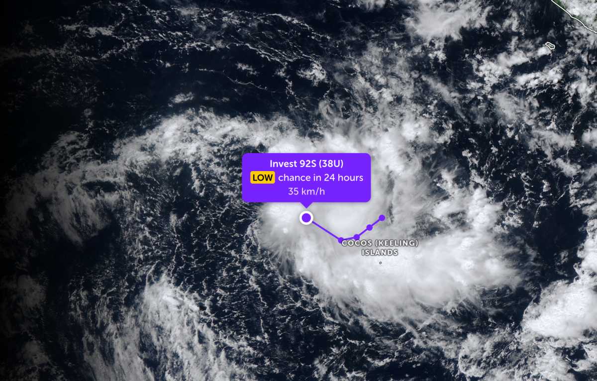
According to the latest low pressure forecast from the Joint Typhoon Warning Center, a new low pressure has formed in the Indian Ocean.
As of the afternoon of April 15, the center of the low pressure bearing the symbol Invest 92S is located near the Cocos Islands (Keeling) in the southern Indian Ocean. The low pressure is forecast to have little chance of developing into a tropical storm in the next 24 hours.
Due to the influence of the low pressure, the area of the Cocos archipelago is cloudy, with scattered showers and thunderstorms, especially heavy rain late at night and near dawn. The thunderstorm situation will last until the end of the week.
In the East Sea, according to the National Center for Hydro-Meteorological Forecasting, in the Gulf of Tonkin area, the weather is generally rainless, visibility over 10km. South to Southeast wind level 4-5, waves 1.5 - 2.5m high, sea at an average level.
The area from Quang Tri to Khanh Hoa has relatively stable weather. No rain in the north, showers in some places in the south. Visibility over 10km, Southeast to Southwest wind level 4-5, waves about 1.0 - 2.0m high.
The area from Lam Dong to An Giang is mainly rainless, good visibility over 10km. Light wind, low waves from 0.5 - 1.5m, relatively calm sea.
The North East Sea and Hoang Sa archipelago areas are rainless, visibility over 10km. South to southwest wind level 4, waves 1.0 - 2.0m high. The central East Sea area also maintains good weather, southeast to south wind level 3-4, waves similarly high.
Meanwhile, in the South China Sea, the Truong Sa archipelago and the Gulf of Thailand, showers and thunderstorms appear in some places. Visibility over 10km but need to be wary of decreasing when there are thunderstorms. Light wind, low waves from 0.5 - 1.5m.
People and tourists operating at sea need to closely monitor weather forecasts, especially in the South China Sea, Truong Sa and Gulf of Thailand due to thunderstorms, potential risks of tornadoes and strong gusts of wind. Small vehicles should limit going out to sea during thunderstorms, ensure full safety equipment and maintain communication to promptly handle situations.
On land, from the night of April 16 to April 17, due to the influence of cold air compressing low pressure troughs combined with wind convergence above 1500m, in the Northern region (except Lai Chau, Dien Bien) and Thanh Hoa there will be rain, moderate rain and scattered thunderstorms with rainfall from 20-40mm, locally very heavy rain over 100mm. From April 17, the North will turn cool.


