According to new low pressure information from the Philippine Atmospheric, Geophysical and Astronomical Services Administration ( pagasa), it is monitoring a low pressure area operating outside the Philippine Area of Responsibility (PAR).
The low pressure is unlikely to develop into a tropical depression within the next 24 hours.
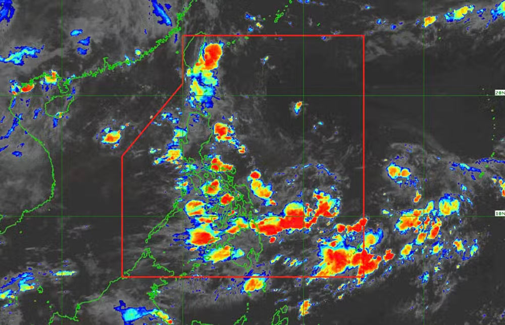
According to the updated bulletin at 8:00 a.m., this low pressure was determined to be about 1,410 km east of Central Luzon.
Meanwhile, another low pressure is active in the waters near the Northern Mariana Islands, in the western Pacific Ocean, according to the US Joint Typhoon Warning Center (JTWC).
The low pressure has the strongest wind near the center of about 30km/h, and is unlikely to strengthen into a tropical depression in the next 24 hours.
Scattered thunderstorms appeared in the capital Manila and 8 other provinces and cities on Luzon Island of the Philippines.
Tourists in these areas need to pay attention to weather forecasts, check flight, ship, ferry information and adjust their schedules accordingly in case of bad weather.
Meanwhile, according to the National Center for Hydro-Meteorological Forecasting, on June 29, in the northern Gulf of Tonkin, the northern East Sea (including the sea area of Hoang Sa archipelago) and the Gulf of Thailand, there will be showers and thunderstorms.
On Phu Quy island, southwest winds have been recorded at level 5, sometimes level 6, gusting to level 7.
Forecast of rain during the day and night of June 29, the Northern Gulf of Tonkin, the Northern East Sea (including the sea area of Hoang Sa archipelago) and the Gulf of Thailand will continue to have showers and thunderstorms.
In addition, the sea area from Binh Thuan to Ca Mau has strong southwest winds of level 5, sometimes level 6, gusting to level 7. Waves are 1.5 - 2.5m high, rough seas.
All ships operating in the above areas are at high risk of being affected by tornadoes, strong gusts of wind and big waves.
From the evening of June 29 to the evening of July 1, in the Northern region, there will be moderate rain, heavy rain and thunderstorms, locally very heavy rain. The common rainfall is about 70-150mm, locally over 300mm.
From the evening of June 29 to June 30, in Thanh Hoa and Nghe An, the Central Highlands and the South, there will be showers and scattered thunderstorms, locally heavy rain with rainfall of 10-30mm, some places over 50mm (rain concentrated in the evening and at night).


