According to the Philippine Atmospheric, Geophysical and Astronomical Services Administration, on the morning of June 27, a low pressure area was identified outside the PAR area.
The low pressure is located at about 14.8 degrees North latitude, 140.0 degrees East longitude, about 1,710km east of Southeast Luzon.
The low pressure is unlikely to develop into a tropical depression in the next 24 hours.
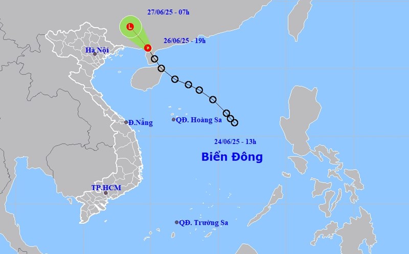
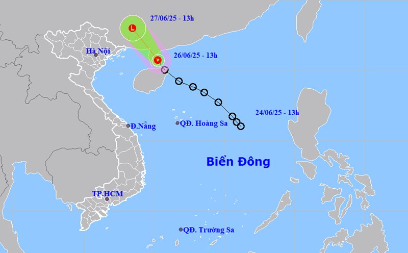
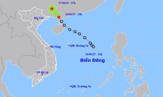
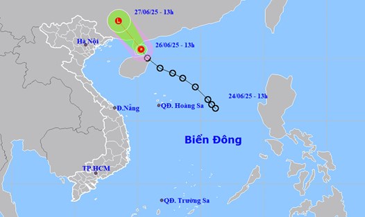
Meanwhile, the tropical depression in the East Sea has weakened into a depression after making landfall in southern China's Guangxi Province, according to the National Center for Hydro-Meteorological Forecasting.
This low pressure area continues to move northwest, moving deep into the mainland south of Quang Tay province, weakening and gradually dissipating, no longer likely to affect Vietnam.
Forecast for the day and night of June 27, scattered showers and thunderstorms will continue in the western sea area of the northern Gulf of Tonkin; the eastern sea area of the North and Central East Sea; the southern East Sea area (including Truong Sa archipelago) and the Gulf of Thailand.
During thunderstorms, there is a possibility of tornadoes and strong gusts of wind of level 6-7.
All ships operating in the above sea areas are at risk of being affected by tornadoes and strong gusts of wind.
The low pressure is forecast to cause heavy rain in Guangdong province, China.
According to Xinhua, as of June 26, at least six people have been killed and tens of thousands more have been evacuated due to widespread heavy rain and flooding in southern China's Guangdong, Guangxi, Guizhou and Hubei provinces since June 17.
Tourists in the above areas need to pay attention to weather forecasts, follow the instructions of local authorities and proactively implement safety measures.