According to the National Center for Hydro-Meteorological Forecasting, by 10:00 p.m. on July 6, storm No. 2 DANAS had left the East Sea. The center of the storm is located at 23.5 degrees North latitude - 120.0 degrees East longitude, in the western outskirts of the island of Taiwan (China). The strongest wind near the storm center is level 12 (118-133km/h), gusting to level 15.
Storm No. 2 continues to move north-northeast at a speed of 2025km/h and gradually weakens.
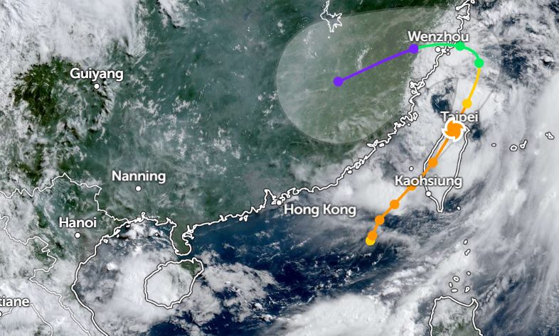
By 2:00 a.m. on July 7, storm No. 2 DANAS had entered Taiwan (China). The center of the storm is located at about 23.8 degrees North latitude - 120.8 degrees East longitude. The strongest wind intensity near the storm center is about 130km/h, gusting over 180km/h.
The storm is moving northeast at a speed of 25km/h. Storm No. 2 is forecast to no longer be likely to return to the East Sea.
The National Center for Hydro-Meteorological Forecasting said that on July 7, the North East Sea (including Hoang Sa special zone) and the sea area from Ca Mau to An Giang will have showers and thunderstorms.
It is forecasted that during the day and night of July 7, scattered showers and thunderstorms will continue to occur in the northern areas of the East Sea (including the Hoang Sa special zone), the east of the Central East Sea, the sea area from Lam Dong to Ca Mau, the sea area from Ca Mau to An Giang, and the Gulf of Thailand. During thunderstorms, there is a possibility of tornadoes and strong gusts of wind.
The northeastern sea area of the North East Sea and the sea area from Khanh Hoa to Vinh Long will have strong southwest winds of level 5, sometimes level 6, gusting to level 7-8. High waves: 2.0-3.0m.
Tourists planning to travel to Taiwan (China) and neighboring areas during this time should pay attention to weather forecasts. Check flight schedules and follow instructions from local authorities to ensure safety.


