According to the latest weather forecast from the Philippine Atmospheric, Geophysical and Astronomical Services Administration (PAGASA), a low pressure is strengthening near the East Sea, entering the Philippine Area of Responsibility (PAR).
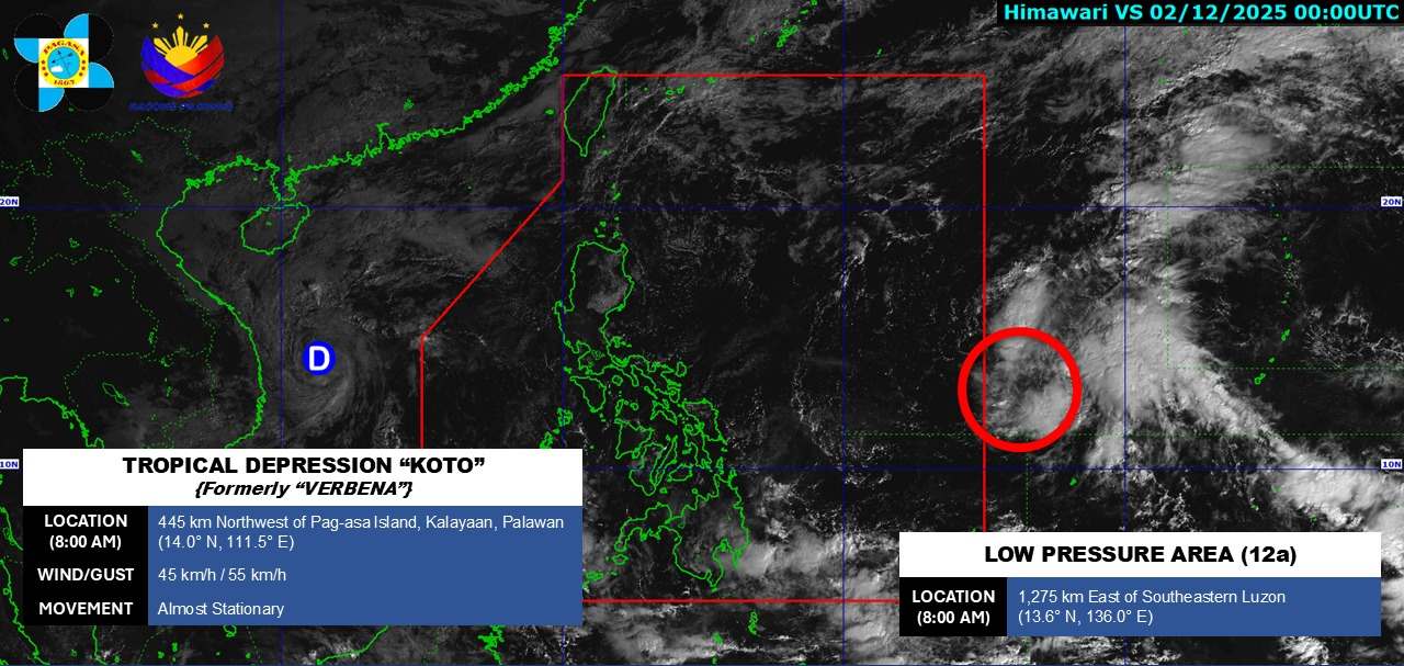
As of 8:00 a.m. this morning (local time), the center of the low pressure was at about 13.6 degrees North latitude - 136.0 degrees East longitude, about 1,275 km east of Southeast Luzon. The low pressure is forecast to strengthen into a tropical depression in the next 24 hours.
PAGASA forecasts that this week, the tropical depression will move across the Philippine mainland to the East Sea. Next week, the tropical depression will move deep into the East Sea, approaching the southern waters of our country.
Meanwhile, the tropical depression weakened by storm No. 15 is still active in the East Sea. At 8:00 a.m. this morning, the center of the tropical depression was at about 14.2 degrees North latitude - 111.2 degrees East longitude, in the Northwest sea of the Central East Sea. The strongest wind is level 6, gusting to level 8. The tropical depression moved slowly in the South-Southwest direction at about 5km/h.
By tomorrow morning, December 3, the low pressure will move southwest, over the sea of Dak Lak - Khanh Hoa province and gradually weaken into a low pressure area. The strongest wind will decrease to below level 6.
Due to the influence of the low pressure, the northwestern sea area of the Central East Sea and the sea area off the coast of Gia Lai - Dak Lak province will have strong winds of level 6, gusts of level 8; waves 2.0-4.0m high, rough seas.
Ship operating in the above-mentioned dangerous areas are likely to be affected by thunderstorms, whirlwinds, strong winds, and large waves. People and tourists should avoid going to sea when the sea is rough and follow local instructions to avoid dangerous storms.


