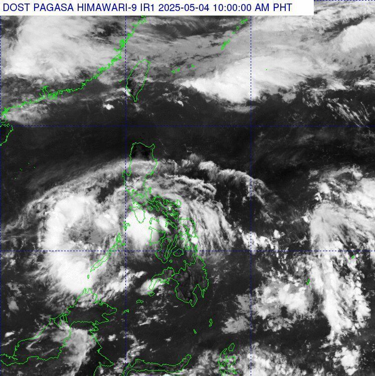
At 3:00 a.m. on April 4 (local time), the low pressure area was determined based on all available data, located about 310 km northwest of Dipolog City, Zamboanga del Norte Province, or about 55 km south-southeast of Cuyo, Palawan.
The Department of Atmospheric, Geophysical and Astronomical Services ( pagasa) forecasts that the low pressure will cause widespread rain and thunderstorms in many areas of Visayas, Mindanao and Southern Luzon today.
According to weather forecast models, the low pressure area will move through Palawan tonight and enter the East Sea on Monday morning, May 5, then gradually weaken.
Despite its weakening, the low pressure area will still affect weather across the Philippines over the next 24 hours.
Rain is forecast in the Visayas, Mindanao, Quezon, MIMAROPA, Bicol and Batangas regions.
Authorities have warned residents and visitors to be vigilant, especially in areas prone to flash floods and landslides.
Local thunderstorms can cause flash floods and dangerous travel conditions in low-lying areas.
By Monday, May 5, the influence of the low pressure area will gradually decrease, giving way to a state of cloudy to few clouds in most areas, with the possibility of scattered thunderstorms in the afternoon and evening.
The low pressure area has not affected Vietnam's marine weather. However, on the morning of April 4, in the eastern sea of the Central and South East Sea, the Gulf of Thailand will have showers and thunderstorms.
The National Center for Hydro-Meteorological Forecasting forecasts that during the day and tonight, April 5, thunderstorms will continue to appear in the eastern sea area of the Central and South East Sea (including the eastern sea area of Truong Sa archipelago), the sea area from Ca Mau to Kien Giang, and the Gulf of Thailand.
During thunderstorms, there is a possibility of tornadoes and strong gusts of wind of level 6-7.
This weather situation poses a high risk to ships operating in the area, with the possibility of tornadoes at sea, strong gusts of wind and large waves.
People and tourists need to pay special attention and closely monitor weather developments to ensure safety when participating in activities at sea.


