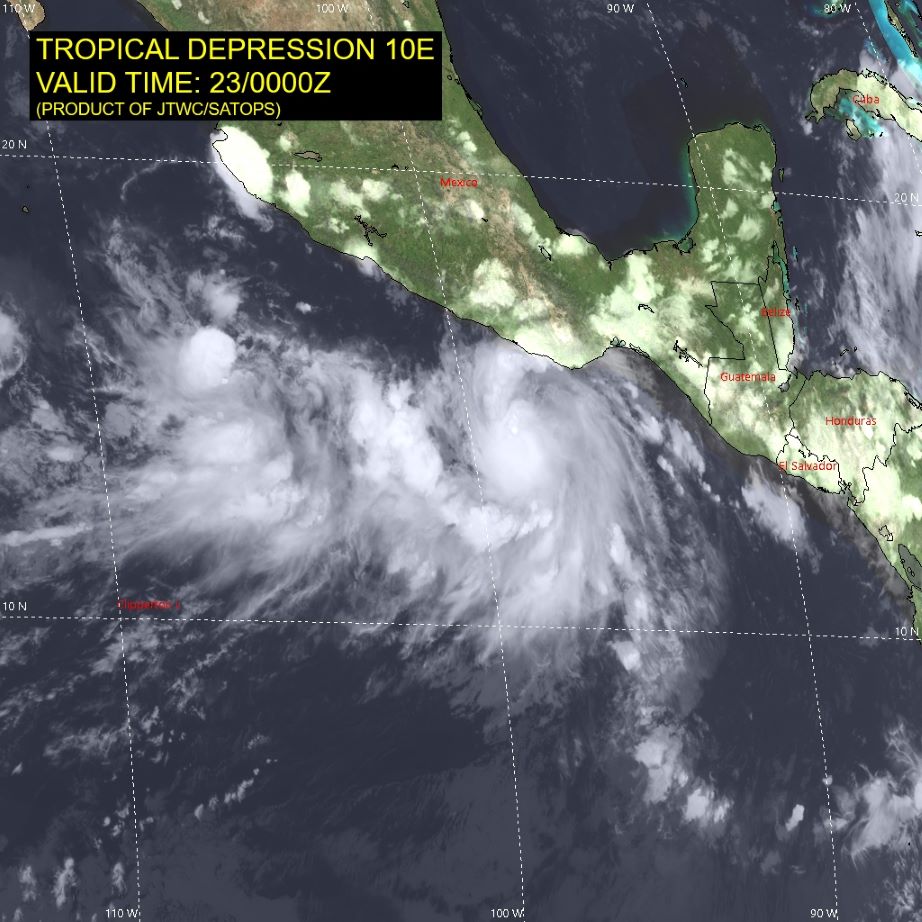
The Joint Typhoon Warning Center (JTWC) of the US Air Force and Navy has just issued the latest announcement about tropical depression named 10E currently operating in the Eastern Pacific region.
According to the latest report at 7:00 a.m. on September 23 (Vietnam time), the center of the low pressure was determined to be at about 13.9 degrees North latitude and 98.6 degrees West longitude, about 2,800 km southeast of San Diego.
Over the past 6 hours, the low pressure has been moving slowly northeast. Currently, the strongest winds near the center of the low pressure remain at around 55 km/h, with the strongest gusts reaching 74 km/h. The lowest central pressure measured is 1003 mb.

Experts predict that the depression will continue to strengthen over the next 72 hours. Tropical Depression #10E could be much stronger than a normal tropical depression. Satellite imagery shows an eyewall forming near the center of the depression. 10E could become a tropical storm and continue to strengthen into a hurricane.
Forecast for the next 24 - 48 hours, at 7:00 a.m. on September 24 (Vietnam time), the low pressure will be at about 14.6 degrees North latitude; 97.9 degrees West longitude; strongest wind at 83 km/h, gusts of 102-130 km/h.
This tropical depression is forecast to weaken into a low pressure area when it moves inland in the next 72 hours.
Currently, the low pressure has not directly affected the mainland, but ships operating in the area need to closely monitor the storm's developments and take safety measures. Tourists planning to travel to southern Mexico should pay attention to weather forecasts and follow the recommendations of authorities, especially in localities such as Oaxaca, Chiapas...


