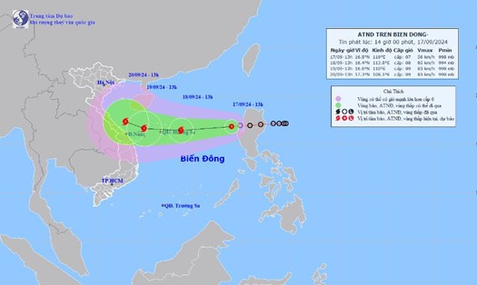
According to the latest news from the National Center for Hydro-Meteorological Forecasting, at 9:00 a.m. on September 18, the center of the tropical depression was at about 16.9 degrees North latitude - 113.4 degrees East longitude, about 213 km east of Hoang Sa archipelago. The strongest wind near the center of the tropical depression is level 7 (50-61 km/h), gusting to level 9. In the next 3 hours, the tropical depression will move west at a speed of about 10-15 km/h.
It is forecasted that in the next 24 hours, the tropical depression will likely strengthen into a storm, level 8 intensity, gusting to level 10.
It is forecasted that by 7am on September 19, the tropical depression will move west-southwest at a speed of about 20km/h, strengthening into a storm. This is forecast to be the fourth storm of the 2024 storm season in Vietnam.
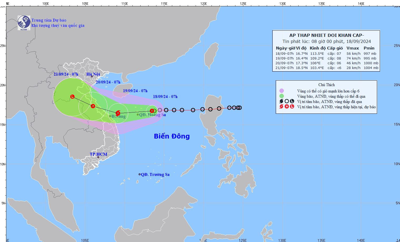
The center of the tropical depression is located at 16.4 degrees North latitude - 109.2 degrees East longitude, about 210km East Southeast of Quang Tri, about 120km East of Da Nang. The wind intensity is strong at level 8, gusting to level 10. The area affected by the natural disaster includes the western sea area of the North East Sea (including the Hoang Sa archipelago), the sea area from Quang Tri to Quang Ngai (including Ly Son island, Cu Lao Cham, Con Co).
At 7:00 a.m. on September 20, storm No. 4 moved in the West-Northwest direction at a speed of about 15 km/h, entered the mainland and gradually weakened into a tropical depression. The center of the storm was located at 17.3 degrees North latitude -106.0 degrees East longitude, located on the Vietnam - Laos border area. The wind intensity was strong at level 6, gusting to level 8. The affected area included the western sea area of the North East Sea (including the Hoang Sa archipelago), the sea area from Nghe An to Quang Ngai (including Ly Son island, Cu Lao Cham, Con Co, Hon Ngu).
Warning in the next 48 to 72 hours, the tropical depression will move in the West Northwest direction, traveling 10-15km per hour, weakening into a low pressure area.
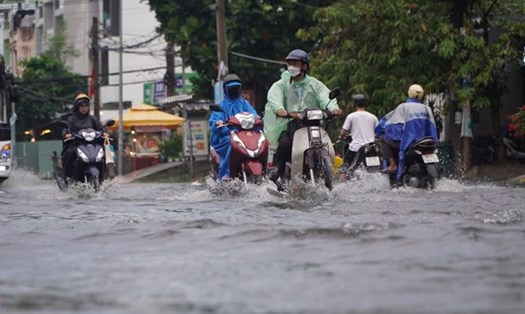
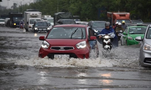
From September 18 to September 20, in the North and Central Central regions, there will be heavy to very heavy rain with common rainfall from 100-300mm, locally over 500mm. From September 18 to September 19, the Central Highlands and the South will have moderate rain, heavy rain and thunderstorms, locally very heavy rain with common rainfall from 40-80mm, some places over 150mm (rain concentrated in the afternoon and night).
Under the impact of storm No. 4, the North East Sea area (including Hoang Sa archipelago), the sea area from Nghe An to Quang Ngai (including Ly Son island district, Cu Lao Cham, Con Co, Hon Ngu) has strong winds of level 6-7, waves 2-4m high, the area near the storm center has level 8 (62-74km/h), gusts of level 10 (89-102km/h), waves 3-5m high, rough seas. Ships operating in these dangerous areas are likely to be affected by storms, whirlwinds, strong winds, and big waves.
Coastal provinces from Quang Binh to Quang Nam need to be on guard against high tides combined with big waves causing landslides of sea dykes, sea embankments, and flooding in low-lying areas.
From early morning and September 19, the coastal mainland from Ha Tinh to Quang Ngai will have winds gradually increasing to level 6-7, near the storm's eye level 8 (62-74km/h), gusting to level 10 (89-102km/h), deep inland there will be gusts of level 6-7.
Tourists planning to travel from Nghe An to Quang Ngai (including Ly Son Island, Cu Lao Cham, Con Co, Hon Ngu) from now until September 20 should pay attention to weather forecasts to choose a reasonable schedule, regularly update announcements from airlines, tour operators, hotels... and information from functional agencies and local authorities.