New low pressure likely to appear this weekend

Chí Long |

According to the latest weather forecast, a low pressure area is likely to form and enter the Philippine Area of ​​Responsibility (PAR) this weekend.

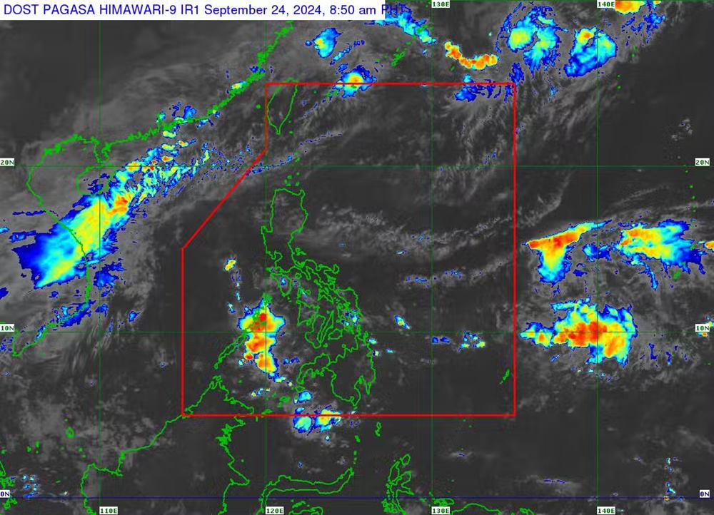
According to a new bulletin from the Philippine Atmospheric and Geophysical Services Administration (PAGASA), a low pressure area may appear over Northern Luzon (Philippines) on September 27-28.

PAGASA weather expert Rhea Torres said the depression may only affect the Philippines' Batanes and Babuyan islands.

"But this scenario is subject to change as the weekend is still a long way off," she said.

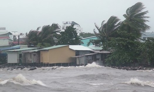
“Due to the temporary weakening of the southwest monsoon, the easterly winds are bringing scattered showers or thunderstorms, especially over the eastern parts of Southern Luzon, Visayas and Mindanao (Philippines),” the expert said.

Ap thap nhiet doi sap hinh thanh o Thai Binh Duong gan Philippines vao cuoi tuan nay. Anh: PAGASA
A tropical depression is likely to form in waters near the Philippines this weekend. Photo: PAGASA

Previously, the Philippine Atmospheric, Geophysical and Astronomical Services Administration predicted that between September 20 and October 3, the country would likely face four tropical depressions.

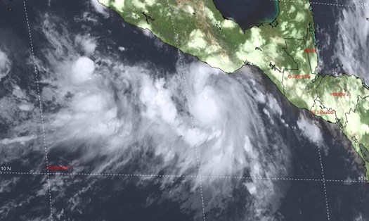
Of which, tropical depression Igme has left the forecast area of ​​the Philippines since September 21.

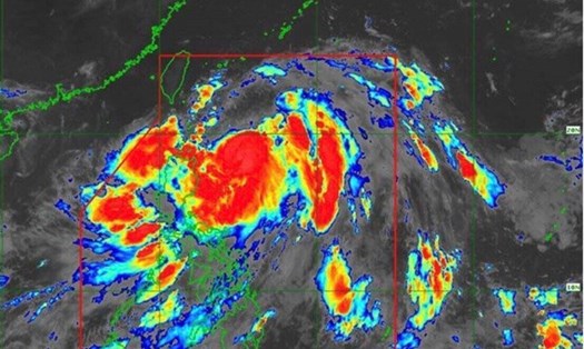
During the week of September 20-26, at least three tropical depressions are forecast. Two of them may form in the northern part of the East Sea and near the East Sea, with the potential to become tropical storms. The third depression is expected to develop in the eastern part of the PAGASA Tropical Cyclone Information Domain (TCID).

From September 27 to October 3, the third low pressure is forecast to move westward and a fourth low pressure may appear northeast of the forecast area.

Tourists planning to visit the Philippines and neighboring countries and territories in the near future should pay close attention to forecasts to adjust their schedules in case the weather turns bad.

Chí Long
TIN LIÊN QUAN

Dự báo thời tiết hôm nay 24.9: Rãnh áp thấp gần biển Đông gây mưa to

MINH ANH |

Dự báo thời tiết hôm nay 24.9 rãnh áp thấp gần Biển Đông gây mưa to, biển động; lũ sông lên cao gây ngập ở nhiều tỉnh thành.

Áp thấp có khả năng mạnh lên thành bão ở Thái Bình Dương

NGUYỄN ĐẠT |

Cơ quan khí tượng phát đi cảnh báo về áp thấp nhiệt đới đang hoạt động ở khu vực Đông Thái Bình Dương đang tiếp tục mạnh lên trong 24 giờ tới.

Áp thấp nhiệt đới và bão liên tục hoạt động đến hết tháng 9

NGUYỄN ĐẠT |

Cơ quan khí tượng của Philippines cảnh báo nước này phải đối mặt với 4 áp thấp nhiệt đới có khả năng xuất hiện từ nay đến 3.10.

Weather Forecast today 9/24: Low pressure trough near the East Sea causes heavy rain

MINH ANH |

Weather Forecast today, September 24: Low pressure trough near the East Sea causes heavy rain, rough seas; rising rivers cause flooding in many provinces and cities.

Low pressure likely to strengthen into storm in Pacific Ocean

NGUYỄN ĐẠT |

The meteorological agency issued a warning that the tropical depression currently active in the East Pacific region is continuing to strengthen in the next 24 hours.

Tropical depressions and storms continue to be active until the end of September

NGUYỄN ĐẠT |

The Philippine meteorological agency warned that the country faces four tropical depressions that are likely to appear between now and October 3.