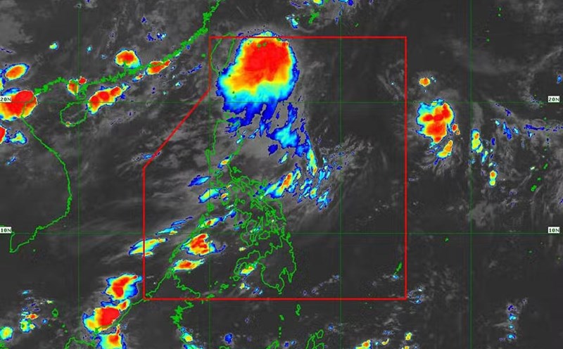
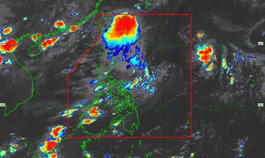
According to the latest weather forecast of the National Center for Hydro-Meteorological Forecasting, at 1:00 p.m. on September 17, the center of the tropical depression was located at about 16.8 degrees North latitude, 119.0 degrees East longitude. The depression is located in the eastern sea of the North East Sea, about 820km east of the Hoang Sa archipelago.
The strongest wind near the center of the tropical depression is level 7 (50-61km/h), gusting to level 9. The depression moves mainly to the West at a speed of about 25km/h.
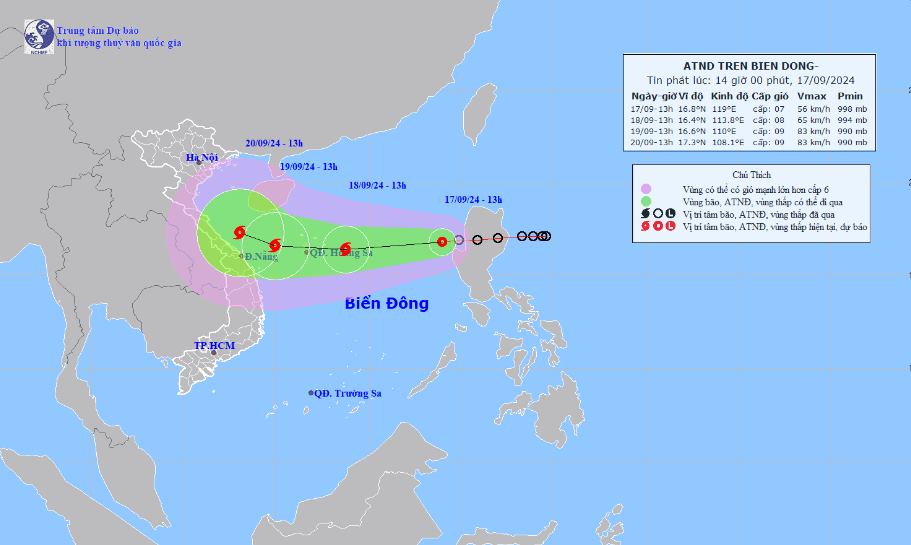
It is forecasted that in the next 24 to 48 hours, the tropical depression will likely strengthen into a storm, with intensity of level 8-9, gusting to level 10-11. If it strengthens into a storm, this will be the fourth storm to make landfall in Vietnam this year.
It is forecasted that by 1:00 p.m. on September 18, storm No. 4 will move in a West-Southwest direction at a speed of about 20-25 km/h. The center of the storm is located at 16.4 degrees North latitude - 113.8 degrees East longitude, about 240 km east of Hoang Sa archipelago. Wind intensity is strong at level 8, gusting to level 10. Natural disaster risk level 3, affecting the North East Sea area.
At 1:00 p.m. on September 19, the storm moved west, slowing down to 15-20 km/h. The center of the storm was located at 16.6 degrees North latitude - 110.0 degrees East longitude, about 250 km east-southeast of the mainland from Quang Binh to Da Nang provinces.
Wind intensity is level 8-9, gusting to level 11. Warning level 3 natural disaster risk, affecting the North East Sea area (including Hoang Sa island area) and the sea area from Quang Binh to Quang Ngai.
It is forecasted that in the next 48 to 72 hours, the storm is likely to change direction, moving in a West Northwest direction, traveling about 10km per hour.
Due to the influence of the storm, the North East Sea area has strong winds of level 6-7, the area near the storm's center has winds of level 8 (62-74km/h), gusts of level 10 (89-102km/h), and rough seas.
In the North East Sea, waves are 2.0-4.0m high, and near the storm center, 3.0-5.0m high. Ships operating in the above-mentioned dangerous areas are likely to be affected by strong winds and large waves.
People and tourists who need to travel by plane or travel to the area from Quang Binh to Quang Ngai during this time should pay attention to weather conditions and arrange a suitable schedule to avoid danger due to natural disasters.