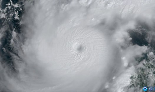
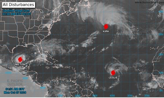
According to the latest storm report from CNN, with sustained winds of 290 km/h, Hurricane Milton is the strongest storm on the planet this year. Superstorm Milton has become one of the 10 strongest storms ever recorded in the Atlantic Ocean.
According to the latest hurricane forecast from the US National Hurricane Center (NHC), Hurricane Milton continues to strengthen and is still a Category 5 hurricane.
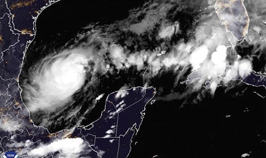
Hurricane Milton brought fierce winds of up to 250km/h as it moved across the northern edge of Mexico's Yucatan Peninsula. Forecasters from the US National Hurricane Center (NHC) said the storm was "potentially catastrophic" along coastal areas.
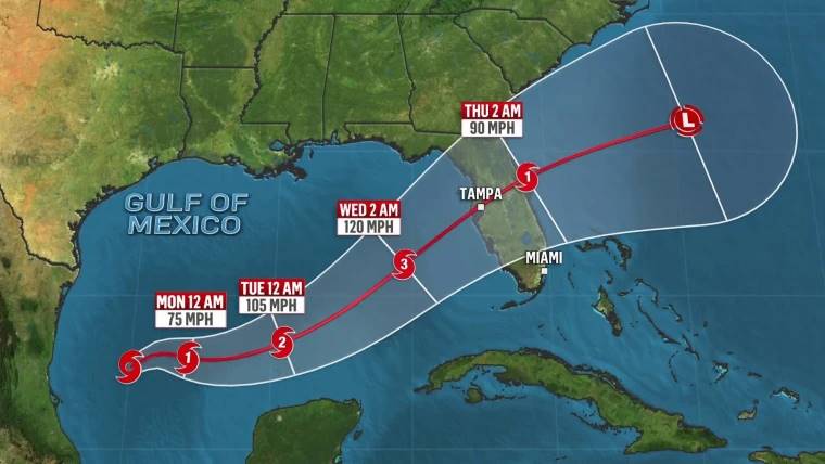
The storm is expected to hit the populous city of Tampa with devastating force on October 9 (local time), less than two weeks after the area was devastated by Hurricane Helene.
Locals have been urged to prepare for the largest evacuation in Florida in years, with Governor Ron DeSantis warning that there is little time left to evacuate.
"We have to acknowledge that this storm is going to be a monster," DeSantis said at a press conference on the afternoon of October 7 (local time), as officials warned of this year's category five storm.

The Milton warning comes just 10 days after Hurricane Helene, the deadliest storm to hit the southeastern United States since Hurricane Katrina in 2005, killed at least 230 people and left hundreds missing.
Currently, 51 of the 67 counties that were devastated by Hurricane Helene are under emergency warnings as Hurricane Milton approaches.
Ken Graham, director of the US National Weather Service (NWS), said Hurricane Milton had become a Category 5 storm with record-breaking speed - with winds increasing by 90mph in 24 hours.
According to the NWS, hurricanes that reach category three or higher are considered major hurricanes because they have the potential to cause significant damage and loss of life.
Hurricane Milton is expected to weaken as it moves across the Gulf of Mexico on October 8, dropping to a Category 3 storm by the time it makes landfall in Tampa Bay, Florida, late on October 9 or early on October 10 (local time).
The National Hurricane Center warned that heavy rain and flash flooding were possible in parts of Florida late on Friday, Oct. 7. The agency also said that high seas and strong winds were possible along parts of Florida's west coast late on Friday and early on Friday.
Total rainfall could reach locally highs of 380mm and coastal areas could see water levels rise by 3-4.5m.
Counties began issuing evacuation orders at 7.10 (local time) and toll roads in western and central Florida will be suspended.
Long lines at gas stations have begun to appear in South Florida. Some reports say gas stations are running low on fuel.
Governor DeSantis announced that traffic congestion in some areas has increased to 90% of the average. Schools in some districts will begin closing on October 8.
If you have flights scheduled to or from many areas of Florida during this time, you may face flight delays or cancellations.
Travelers should stay up to date with the latest weather information, as Hurricane Milton could have a negative impact on their travel plans. Consider postponing or canceling your trip to stay safe.


