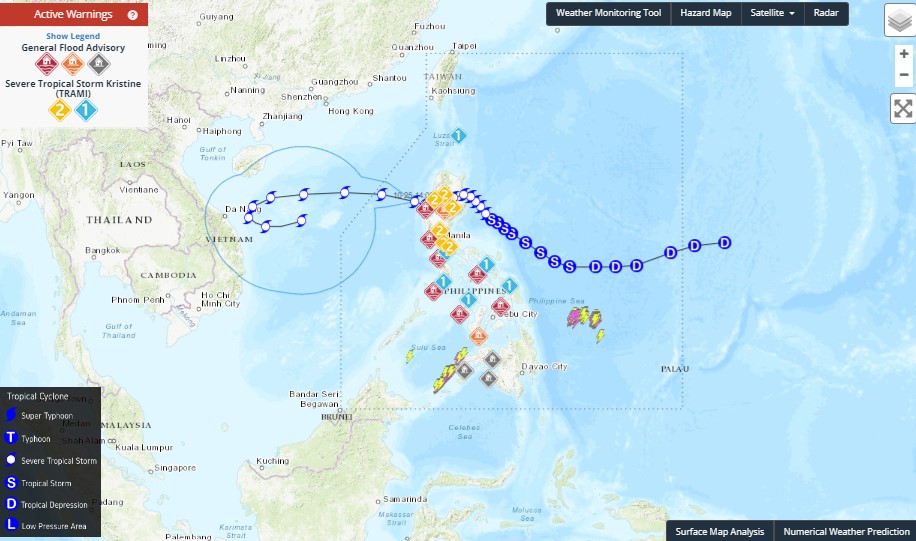
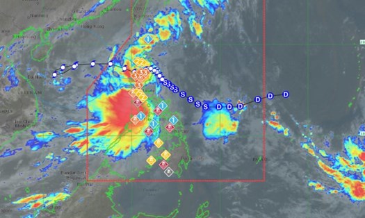
According to the latest weather forecast from the National Center for Hydro-Meteorological Forecasting, at 7:00 a.m. on October 25, the center of the storm was located at approximately 17.1 degrees North latitude - 118.6 degrees East longitude, in the eastern sea of the North East Sea. The strongest wind near the center of the storm is level 10 (89-102 km/h), gusting to level 12. The storm is moving westward at a speed of approximately 15 km/h.
It is forecasted that by 7am on October 26, the storm will move in a West-Northwest direction, increasing its speed to 15-20km/h. The center of the storm is located at about 17.5 degrees North latitude - 114.0 degrees East longitude, in the North East Sea, about 210km East-Northeast of the Hoang Sa archipelago. The strongest wind near the center of the storm is level 11-12, gusting to level 15. Risk level: level 3 for the North East Sea (including the area east of the Hoang Sa archipelago).

At 7:00 a.m. on October 27, the storm will move in a West-Southwest direction, at a speed of 15-20 km/h. The center of the storm is located at about 17.0 degrees North latitude - 110.0 degrees East longitude, in the northwest area of the Hoang Sa archipelago. The strongest wind near the center of the storm is level 11, gusting to level 14. Risk level: level 3 for the North East Sea area (including the Hoang Sa archipelago).
Forecast at 7am on October 28, the storm is moving in a West-Southwest direction, then changing direction to East-Southeast. Storm No. 6 suddenly turns back to the East Sea when approaching the mainland of Central Vietnam. The storm moves slowly at a speed of 10km/h. The center of the storm is located at about 15.9 degrees North latitude - 110.0 degrees East longitude, in the sea off the Central Central Coast, about 180km West-Southwest of Hoang Sa archipelago.
The strongest wind near the storm center is level 10, gusting to level 12. Risk level: level 3 for the western part of the North East Sea (including the western part of the Hoang Sa archipelago), the sea off the Central Central Coast.
Warning from the next 72 to 120 hours, the storm moves slowly, is likely to change direction to the East, moving about 10km per hour, and continues to weaken.
Under the impact of the storm, the eastern sea area of the North East Sea has strong winds of level 8-9, near the eye of the storm level 10-12 (89-133km/h), gusts of level 15, waves 5.0-7.0m high, near the eye of the storm 7.0-9.0m; rough seas. Ships operating in the above-mentioned dangerous areas are likely to be affected by storms, whirlwinds, strong winds, and large waves.
As of now, storm No. 6 is forecasted to have an erratic and complex trajectory. People and tourists planning to travel to the Central region or the sea during this time should pay close attention to weather forecasts to arrange a suitable schedule.


