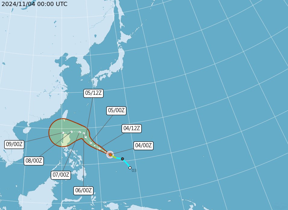
According to the Philippine Atmospheric, Geophysical and Astronomical Services Administration (Pagasa), Typhoon Yinxing (local name in the Philippines: Marce) may continue to strengthen today, November 5, and reach typhoon level until it leaves the Philippine Area of Responsibility (PAR).
In a 5 a.m. bulletin on Nov. 5, the state weather agency said the storm was located 735 kilometers (465 miles) east of Baler, Aurora. The storm was maintaining maximum sustained winds of 110 kilometers per hour (68 mph) near its center and gusts of up to 135 kilometers per hour (84 mph).
The storm is moving northwest at 25 km/h.

According to the storm's track forecast from Pagasa, Typhoon Yinxing will move mainly northwest until Wednesday morning (November 6) before slowing down and turning westward over the Philippine Sea, east of northernmost Luzon.
The storm could make landfall in the Babuyan Islands area or north of mainland Cagayan late Thursday (November 7) or early Friday (November 8), Pagasa said.
According to Pagasa weather expert Rhea Torres, the storm's area of influence is wide and will cover some parts of northern Luzon, Philippines and gradually approach the mainland of the island nation.
Pagasa has also issued a strong wind warning for the northern and eastern seas of Northern Luzon, particularly the coasts of Batanes and Cagayan including Babuyan and Isabela Islands.
Typhoon Yinxing is expected to leave PAR on Friday evening (November 8) or Saturday morning (November 9).
Currently, many areas in the Philippines, Taiwan (China), and Cambodia are experiencing rain due to the storm.
A more accurate forecast of the storm's path will be released on November 6, according to the China Weather Administration (CWA).
The storm is likely to enter the East Sea from November 9 and become the 7th storm of the 2024 storm season in Vietnam.


