Hurricane Milton is approaching the Florida coast, posing a serious threat to life and property in the area, the US National Hurricane Center (NHC) said.
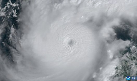
According to the latest news from the NHC, at 4:00 a.m. on October 8 (local time), Milton is now a Category 5 hurricane. In just 36 hours, the storm's maximum winds have increased rapidly from 89 km/h to 290 km/h. Milton has become the strongest hurricane to operate in the Atlantic Ocean in 2024.
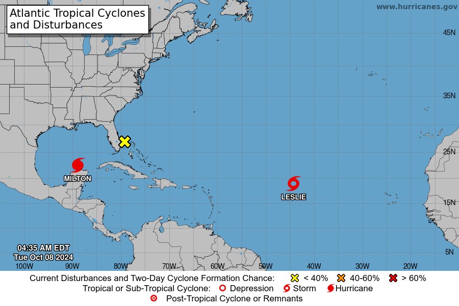
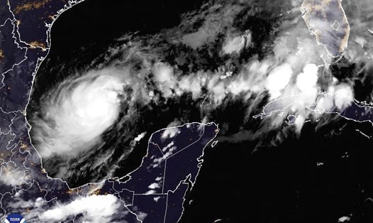
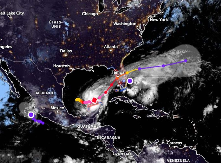
Currently, the center of Hurricane Milton is located about 140 km northeast of Progreso, Mexico and about 905 km southwest of Tampa, Florida.
The storm is moving east-northeast at 12 mph.
Forecasts show Milton moving north of the Yucatan Peninsula today and approaching the west coast of Florida tomorrow, Wednesday. The storm is likely to make landfall in Florida Wednesday night.
In response to the above situation, the NHC has issued emergency warnings for many areas, including:
Storm surge warning from Flamingo to Suwannee River on Florida's west coast.
Hurricane warning for Florida's west coast from Bonita Beach to the Suwannee River.
Tropical storm warnings are in place for several other areas along the coasts of Florida, Georgia and South Carolina.
Additionally, storm surge is forecast to cause severe flooding in many areas. Water levels could rise as high as 10-15 feet from the Anclote River to Englewood and Tampa Bay; 1-10 feet from Englewood to Bonita Beach and Charlotte Harbor; and 5-10 feet from Yankeetown to the Anclote River.
In terms of rainfall, the NHC expects 5 to 12 inches (127 to 305 mm) of rain, with localized totals of up to 18 inches (457 mm) in central to northern portions of the Florida Peninsula. This could cause life-threatening flash flooding, urban flooding, and river flooding.
Hurricane-force winds are expected to begin affecting the Florida west coast warning area as early as Wednesday afternoon, with tropical storm force winds beginning on the morning of Wednesday. A few tornadoes are possible in central and south Florida from the night of Wednesday into the night of October 9.
In the face of unpredictable storm conditions, residents and visitors in the affected areas are advised to follow the instructions of local authorities and take necessary precautions.
Meteorologists stress that Milton is an extremely dangerous storm and its power should not be underestimated. The situation will continue to be updated regularly as new information becomes available.
Tourists planning to travel to the above areas in the near future should cancel or postpone their trips to ensure safety.