According to the latest storm news, Typhoon Yagi - the third storm of the 2024 storm season in Vietnam, officially entered the East Sea on the afternoon of September 3. Wind gusts reached 105 km/h and are expected to continue to increase in intensity if conditions are favorable in the northern part of the East Sea.
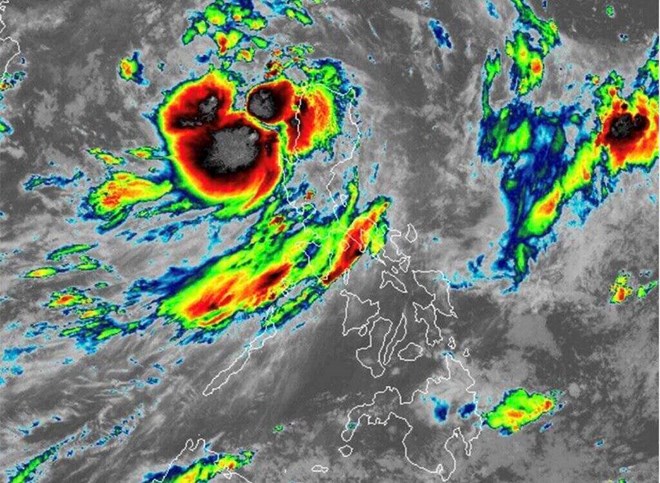
Since the morning of September 3, storm Yagi has strengthened with winds near the storm center reaching about 85 km/h (level 9), gusts up to 105 km/h (level 11) and moving west-northwest at a speed of about 15 km/h.
This tropical storm made landfall in Casiguran, Aurora (Philippines) at 2:00 p.m. on September 2. Due to the impact of Typhoon Yagi, at least 14 people were killed by landslides, floods and rising rivers, according to AP .
According to PAGASA forecast, Typhoon Yagi is expected to leave the Philippine forecast area (PAR) on the morning of September 4. The storm is likely to move towards Hainan Island (China). Typhoon Yagi is likely to make landfall.
Notably, Yagi is likely to strengthen into a typhoon on September 5 when it moves out of PAR, with peak intensity possibly reaching late September 6 or early September 7.
According to the storm forecast bulletin of the Vietnam National Center for Hydro-Meteorological Forecasting, in the next 72 to 120 hours, storm No. 3 will move mainly in the West-Northwest direction, traveling 10-15km per hour, with little change in intensity, then gradually decreasing.
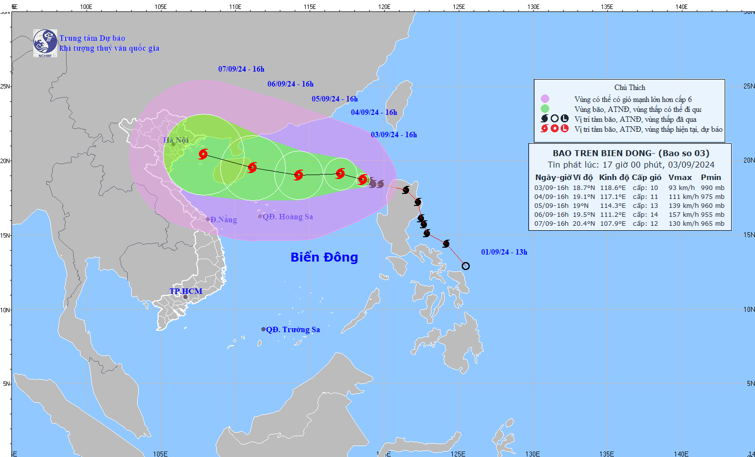
In the next 24 hours, the sea in the eastern part of the North East Sea will have waves 2-4m high, near the storm center 3.0-5.0m. From the night of September 4-6, they may gradually increase to 7-9m. The sea will be rough. Ships operating in the above dangerous areas are likely to be affected by strong winds and large waves.
Given the complex weather conditions, tourists and residents in coastal areas need to be extremely cautious. If you are planning to visit the Northern and North Central provinces or Hainan Island (China), you should pay attention to and update the latest information about the storm from official sources; consider postponing or changing your itinerary.