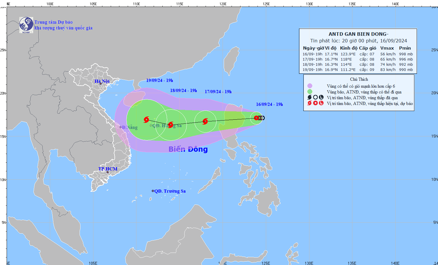
According to the latest news from the National Center for Hydro-Meteorological Forecasting, at 1:00 a.m. on September 17, the center of the tropical depression was located at about 17.0 degrees North latitude; 122.0 degrees East longitude, on the mainland east of Luzon Island (Philippines). The strongest wind near the center of the tropical depression was level 7 (50-61 km/h), gusting to level 9; moving mainly west at about 15 km/h.
Forecast at 1:00 a.m. on September 18, the tropical depression is moving in a West-Southwest direction at a speed of about 25 km/h, entering the East Sea and strengthening into a storm. At this time, the center of the storm is located at 16.6 degrees North latitude - 116.4 degrees East longitude, about 420 km east of Hoang Sa archipelago.
Moving west at about 25km/h, the system quickly strengthened into a storm. The intensity is level 8, gusting to level 10. The area directly affected by the storm is forecast to be concentrated in the East of the North East Sea, east of the 115.0 degree East meridian, between latitudes 15.0 degrees North and 19.0 degrees North. These areas may be affected by strong winds of level 3 or higher.
The Central Highlands and the South have moderate rain, heavy rain and thunderstorms, locally very heavy rain with common rainfall of 40-80mm, locally over 150mm (rain concentrated in the afternoon and night). From September 20, heavy rain in the Central Highlands and the South tends to decrease gradually.
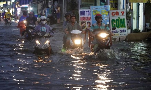
The Northern and Central regions have scattered showers and thunderstorms, locally heavy to very heavy rain with rainfall from 15-30mm, locally over 90mm (rain concentrated in the late afternoon and night).
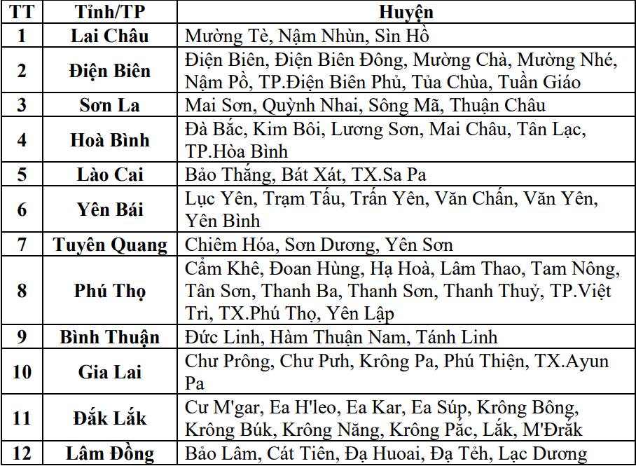
Northern mountainous areas will have thunderstorms from 10-20mm, some places over 30mm; Binh Thuan, Gia Lai, Dak Lak, Lam Dong provinces will have 10-40mm, some places over 60mm. People and tourists need to be on guard against the risk of flash floods on small rivers and streams, and landslides on steep slopes in many districts.
Weather Forecast September 17 in 10 tourist cities of Vietnam:
Hanoi
Lowest temperature: 24-25 degrees Celsius.
Highest temperature: 31 degrees Celsius.
Day and night with showers and thunderstorms, strong winds.
Ha Long
Lowest temperature: 24 degrees Celsius.
Highest temperature: 31-33 degrees Celsius.
Hot and sunny during the day, some rain, high UV index. Showers and strong winds at night.
Ninh Binh
Lowest temperature: 24 degrees C.
Highest temperature: 29-31 degrees C.
Day and night with showers and strong winds.
Hue
Lowest temperature: 23-25 degrees C.
Highest temperature: 31-33 degrees C.
Day and night with occasional showers and thunderstorms.
Danang
Lowest temperature: 24-25 degrees Celsius.
Highest temperature: 31-32 degrees Celsius.
Day and night occasional thunderstorms, strong winds.
Nha Trang
Lowest temperature: 24-25 degrees C.
Highest temperature: 29-33 degrees C.
Showers and thunderstorms day and night.
Dalat
Lowest temperature: 24-25 degrees C.
Highest temperature: 29-32 degrees C.
Day and night with thunderstorms and strong winds.
Ho Chi Minh City
Lowest temperature: 23-24 degrees Celsius.
Highest temperature: 30-31 degrees Celsius.
Scattered showers and thunderstorms during the day. Rain tapering off at night.
Vung Tau
Lowest temperature: 23-25 degrees Celsius.
Highest temperature: 30-31 degrees Celsius.
Day and night with showers and thunderstorms, strong winds.
Phu Quoc
Lowest temperature: 25-28 degrees C.
Highest temperature: 29 degrees C.
Day and night with showers and thunderstorms, strong winds.