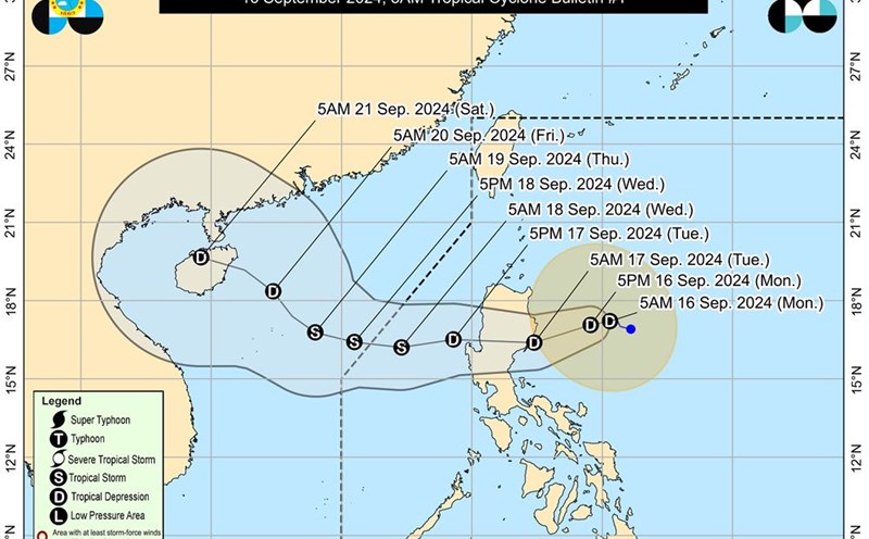
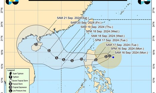
According to the latest storm information from the National Center for Hydro-Meteorological Forecasting, at 1:00 p.m. on September 16, a tropical depression was identified at approximately 17.1 degrees North latitude; 123.9 degrees East longitude, in the sea east of Luzon Island (Philippines).
The strongest winds near the center of the tropical depression are at level 6-7 (39-61 km/h), with gusts up to level 9. This weather system is moving mainly west at a speed of about 15 km/h.
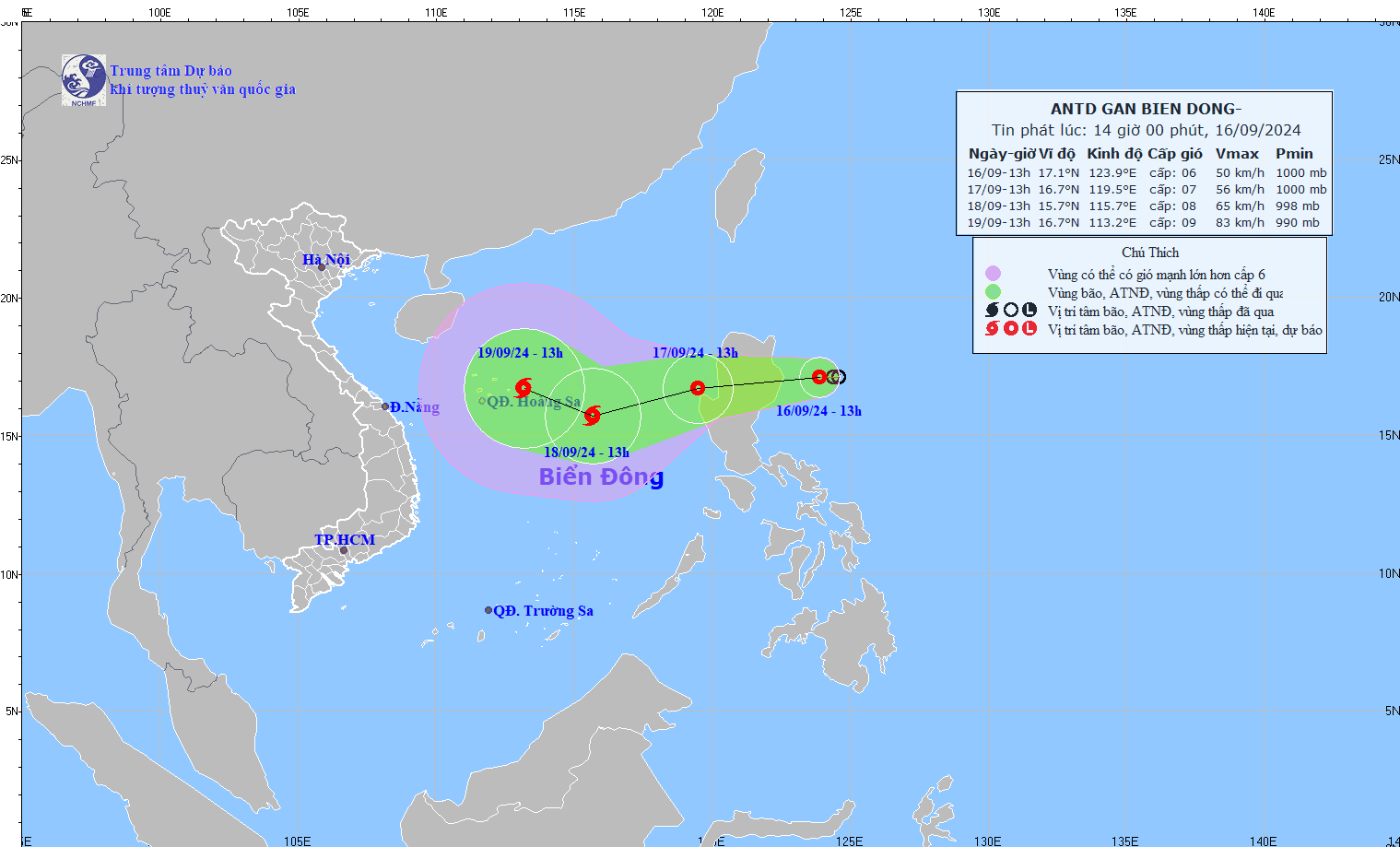
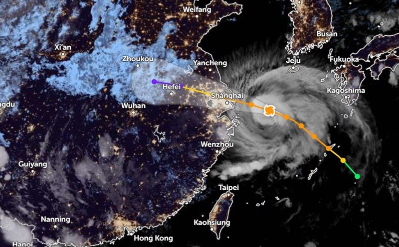
It is forecasted that in the next 24 to 48 hours, at 1:00 p.m. on September 17, the tropical depression is expected to move westward at a speed of 15-20 km/h and move towards the East Sea.
At this time, the low pressure is at about 16.7 degrees North latitude and 119.5 degrees East longitude, in the northeastern sea of the East Sea. The intensity of the tropical depression is forecast to be level 7, with gusts reaching level 9.
The danger zone will be located in the area from 15.0 degrees North latitude to 19.0 degrees North latitude and East of 117.5 degrees East longitude. The expected disaster risk level is level 3 for the affected area, specifically the East of the North East Sea.
At 1 p.m. on September 18, the tropical depression is expected to strengthen into a storm and move west-southwest at a speed of about 20 km/h. The forecast location will be at about 15.7 degrees north latitude; 115.7 degrees east longitude, about 350 km east-southeast of the Hoang Sa archipelago (Vietnam).
The storm is expected to reach level 8 intensity, with wind gusts reaching level 10. The danger zone will cover the area from 14.0 degrees North to 18.0 degrees North latitude and from 114.0 degrees East to 120.0 degrees East longitude. The disaster risk level remains at level 3 for the North East Sea and the North of the Central East Sea.
In the next 48 to 72 hours, the storm is likely to change direction and move west-northwest at a speed of 10-15 km/h.
Regarding the impact, the Hydrometeorological Forecasting Center predicts that from the morning of September 17, the eastern sea area of the North East Sea will have showers and thunderstorms, with strong winds of level 7 (50-61 km/h) and gusts of level 9 (75-88 km/h). The sea will be very rough.
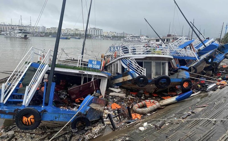
The eastern sea area of the North East Sea has waves ranging from 2 to 4 meters high. Vessels operating in these danger zones are likely to be severely affected by strong winds and large waves.
Residents and tourists in areas predicted to be affected by the tropical depression should regularly monitor weather forecasts to adjust their schedules accordingly and ensure safety.