According to the latest storm information from the US National Hurricane Center (NHC), there are currently two areas in the Atlantic Ocean that are being closely monitored for the possibility of storm formation in the coming days.
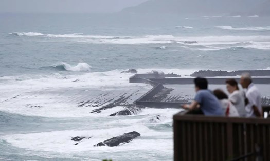
The first area is in the western Atlantic, a few hundred miles southeast of Bermuda, where a low pressure area is creating a small area of showers and thunderstorms.
However, experts predict that dry air and strong upper-level winds will limit further development of this system for at least the next day.
This area of low pressure is expected to move north to the northeast at about 10 mph. The chance of a storm forming in the next 48 hours and in the next 7 days is both assessed at a low level, only about 10%.
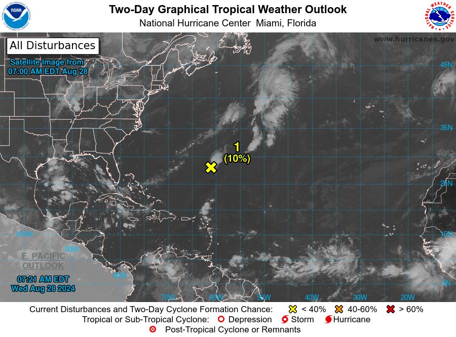
The second area of interest is located in the center of the tropical Atlantic. Meteorologists predict that a low pressure area may form in this area in the next few days.
It is worth noting that environmental conditions appear favorable for the slow development of this system late this week into early next week.
The system is forecast to move west to west-northwest at 10 to 15 mph. Although the chance of formation in the next 48 hours is almost zero, in the next 7 days this probability increases to 20%.
Faced with this situation, if tourists are planning to travel to the Atlantic coastal regions, especially the Bermuda area and the Caribbean next week, please regularly update weather information from major sources. system.
Be flexible in your planning and consider having backup plans for your trip, especially if you plan to visit areas that may be affected by bad weather.
Although the risk of a storm forming is currently considered low, weather conditions can change rapidly, so staying alert and prepared is essential to ensuring a safe and enjoyable trip.
The US National Hurricane Center will continue to closely monitor both areas and provide regular updates. People in coastal areas and nearby islands are advised to monitor the latest weather reports in the coming days.