According to statistics from the Department of Agriculture and Environment of Can Tho City, in 2025, the city recorded 4 types of natural disasters occurring directly, including: riverbank and coastal erosion; heavy rain accompanied by thunderstorms; flooding, high tides and saltwater intrusion. In addition, 15 storms appeared in the East Sea, although they did not directly affect Can Tho City but indirectly affected the regional weather.
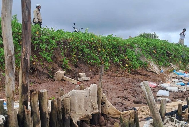
Riverbank and coastal erosion occurred in 121 phases, with a total erosion length of more than 3,000 m, affecting 54 households, estimated damage of about 26.344 billion VND.
Heavy rain accompanied by thunderstorms occurred in 76 phases, affecting 291 households, 2 schools and 1 commune health station; injuring 4 people, estimated damage of about 10.8 billion VND.
The city also recorded 6 floods and waterlogging due to rain and high tides. Notably, during the 9th lunar month high tide (phase 5), coinciding with the time of storm No. 13 (KAMAEGI), many residential areas were deeply flooded; more than 4,900 hectares of agricultural production area and over 120 hectares of aquaculture were flooded, causing significant damage.
Regarding drought and saltwater intrusion, from the beginning of the dry season, 13 waves of saltwater intrusion have appeared on rivers, canals, and ditches such as: Hau River, Cai Lon River, Cai Con River, My Thanh River and Quan Lo - Phung Hiep canal. On the Hau River, saltwater intrusion is many years earlier than the average, starting from the high tide period at the end of December 2024, with strong levels and deep intrusion.
During high tides, salinity increases and lasts, especially from the end of January 2025. The highest salinity measured on the Hau River is higher than the same period last year by 0.9 - 2.8‰, maintained until the end of March and early April 2025 and then gradually decreases. On the My Thanh River and Quan Lo - Phung Hiep canal, salinity strongly intrudes from mid-March to the first half of May 2025, with a salinity higher than the same period last year by 0.2 - 1.2‰.
In 2025, the total amount of support for damage caused by natural disasters in the area is more than 1.4 billion VND.