According to storm news, the latest low pressure from the Philippine Atmospheric, Geophysical and Astronomical Services Administration (PAGASA), a low pressure is strengthening near the East Sea.
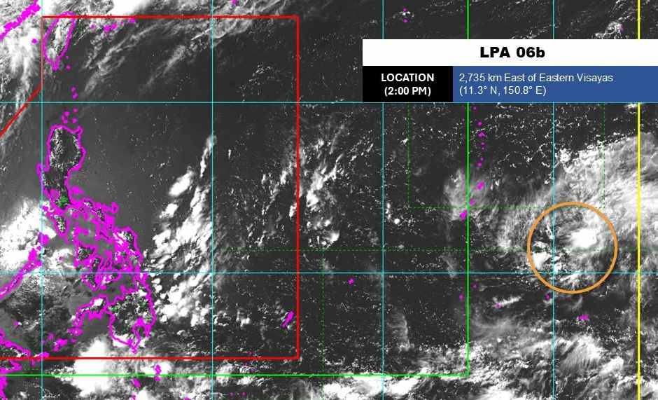
As of 2 pm today (local time), the center of the low pressure was located at about 11.3 degrees North latitude - 150.8 degrees East longitude, about 2,735 km from the Eastern Visayas region.
The strongest wind near the center of the low pressure reached 35 km/h. The low pressure is moving in a West - Northwest direction towards the Philippine area of responsibility.
PAGASA forecasts that the low pressure has the potential to develop into a tropical depression or storm in the next 24 hours.
Because it is still quite far from the mainland, the low pressure has not caused much impact on the adjacent mainland areas.
In the East Sea, according to the National Center for Hydro-Meteorological Forecasting, in the afternoon of June 17, the sea area north of the Northern East Sea, the Northern Gulf area and the Gulf of Thailand had scattered showers and thunderstorms.
Forecast for the night of June 17 and day of June 18, the sea area north of the Northern East Sea, the area of the Northern Gulf of Tonkin, the sea area from Lam Dong to Ca Mau, Ca Mau to An Giang and the Gulf of Thailand will have scattered showers and thunderstorms. In thunderstorms, there is a possibility of tornadoes, strong gusts of wind at level 6-7, sea waves over 2.0m high.
All ships operating in the above areas are at risk of being affected by tornadoes, strong gusts of wind and high sea waves.
People and tourists planning to visit these sea areas should pay attention to weather forecasts. Avoid going out to sea when the sea is rough to ensure safety.


