According to storm news, the latest low pressure from the US National Hurricane Center (NHC), a low pressure area is operating strongly on land in Mexico.
The low pressure bearing the symbol Invest 90L is currently located in the Northeast of Mexico. The strongest wind near the center of the low pressure reaches 30 km/h.
The NHC forecasts that the low pressure has a 50% chance of developing into a tropical depression or tropical storm in the next 2 days, and also has a 50% chance of developing in the next 7 days.
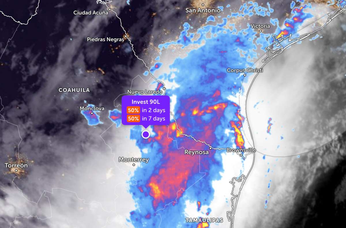
Due to the influence of the low pressure trough, the Northeast region of Mexico has widespread showers and thunderstorms. The low pressure moves slowly on land, possibly returning to the Northwest Gulf of Mexico on June 16 or 17, where conditions are more favorable for developing strongly into a tropical depression or storm.
The NHC warns people and tourists in the South and East of Texas and some areas of Louisiana and Mississippi to prepare to cope with prolonged heavy rains in the next few days.
Heavy rain can also cause widespread flash floods, severe urban flooding and floods on rivers and streams. In addition, strong gusts of wind and coastal flooding can also occur along some areas of the northwest coast of the Gulf of Mexico.
People and tourists planning to visit these areas should pay attention to weather forecasts. Regularly check flight schedules and follow local instructions to avoid dangerous storms throughout the journey.


