According to storm news, the latest low pressure from the US National Hurricane Center (NHC), the low pressure bearing the symbol Invest 90L has officially strengthened into Potential Tropical Cyclone One over the Northwest Gulf of Mexico.
It is forecast that this tropical depression will continue to strengthen and is likely to reach tropical storm level on June 17, when moving along or just off the coast of Texas and Louisiana. Tropical storm monitoring warnings have been issued from Sargent (Texas) to Morgan City (Louisiana).
On June 16, the system was moving slowly in a Northeast direction with sustained winds of about 50 km/h.
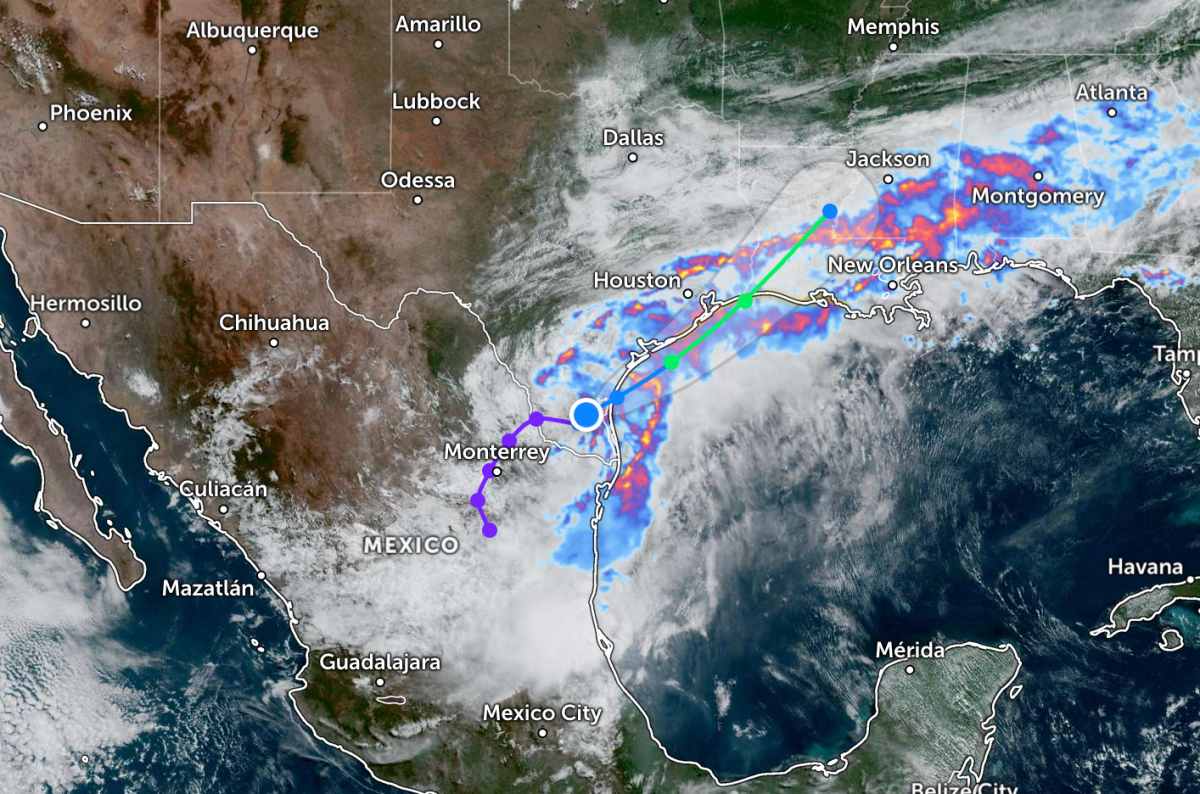
It is forecast that the low pressure will gradually increase its moving speed before approaching or making landfall back in the Texas coastal area by the end of June 17 or early June 18.
Although a clear closed circulation has not yet formed, the tropical depression is creating strong convective clouds and widespread thunderstorms. Experts predict prolonged heavy rain will be the most worrying threat to this system, regardless of whether it develops into a tropical storm or not.
The NHC warns that life-threatening flash floods and urban inundation could occur from the Texas coast extending east to the central Mississippi area in the coming days. Prolonged heavy rains could also cause the risk of flooding to continue until the end of the week.
In addition, coastal flooding from mild to moderate is forecast to appear in some areas along the coast of Texas and Louisiana. Small rivers and streams in this area are also at risk of flooding, while some places may record significant river floods.
People and tourists planning to visit Mexico during this time, especially in areas with tropical depressions passing through, should pay attention to weather forecasts. Regularly check flight schedules and follow local instructions to avoid dangerous storms.


