According to new low pressure information from the Philippine Atmospheric, Geophysical and Astronomical Services Administration (PAGASA), the low pressure area being monitored has approached the Philippine mainland.
As of 3:00 a.m. on July 2 (local time), the center of the low pressure was at about 16.9 degrees North latitude - 123.9 degrees East longitude, about 200km northeast of Casiguran, Aurora. The low pressure is forecast to have a high probability of strengthening into a tropical depression in the next 24 hours.
Due to the influence of the depression, Ilocos region, Cordillera administrative region, Cagayan valley, Aurora, Nueva Ecija, Metro Manila, Calabarzon, Mimabarzon, Bicol region, Western Visayas and the rest of Central Luzon will have cloudy skies with scattered thunderstorms.
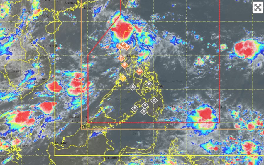
The rest of the Philippines will have cloudy skies with localized thunderstorms. moderate to heavy rain can cause floods and landslides.
Outside the Philippine Area of Responsibility (PAR), a monitored low pressure area has strengthened into a tropical depression. As of 3:00 a.m. on July 2 (local time), the center of the tropical depression was at about 24.3 degrees North latitude - 147.5 degrees East longitude, 2,660 km northeast of the northernmost tip of Luzon.
The strongest wind near the center of the tropical depression is up to 55km/h, gusting up to 70km/h. The tropical depression is moving northwest at a speed of 15km/h.
Because it is still quite far away, the low pressure near the East Sea has not affected the sea areas of Vietnam much.
According to the National Center for Hydro-Meteorological Forecasting, today, July 2, the Gulf of Tonkin will have scattered showers and thunderstorms. Over 10km, down to 4-10km in rain. Southeast wind level 3-4. Waves are 0.5 - 1.5m high.
The sea area from South Quang Tri to Quang Ngai will have scattered showers and thunderstorms in some places. A view of over 10km away, reduced to 4-10km in rain. Light wind, waves 0.5 - 1.5m high.
The Gia Lai - Khanh Hoa sea area will have scattered showers and thunderstorms in some places. A view of over 10km away, reduced to 4-10km in rain. Southwest wind level 4-5. Waves are 1.0 - 2.0m high.
During thunderstorms, there is a possibility of tornadoes and strong gusts of wind of level 6-7.
People and tourists who want to visit these areas should pay attention to weather forecasts. Follow local instructions to ensure safety throughout the journey.


