According to the US Joint Typhoon Warning Center (JTWC), at 7:00 p.m. on July 1 (Vietnam time), a tropical depression with international code 90W formed in the sea northeast of the Northern Mariana Islands in the US.
The tropical depression is located at 22.6 degrees North latitude and 148.2 degrees East longitude.
The tropical depression is moving northwest at a speed of about 10 km/h. Current winds reach 55 km/h.
It is forecasted that in the next 24 hours, tropical depression 90W is likely to strengthen into a storm.
Although no warnings have been issued for land, JTWC meteorologists said the system is interacting with a high-altitude low pressure trough in the west, causing the cloud structure to remain distorted and unstable.
However, when it enters an area with more favorable atmospheric conditions on July 2, the tropical depression will have conditions to strengthen.
Tropical Depression 90W is expected to continue moving slowly northwestward over the next few days, then be likely to slow down and rotate in southeastern Japan.
Currently, the tropical depression is not at risk of directly affecting the mainland in this area within the next 3-5 days.
However, ships operating in the northwest Pacific Ocean need to closely monitor developments and further updates.
Tourists planning to travel or travel by air to Japan and neighboring waters should closely monitor official weather forecasts.
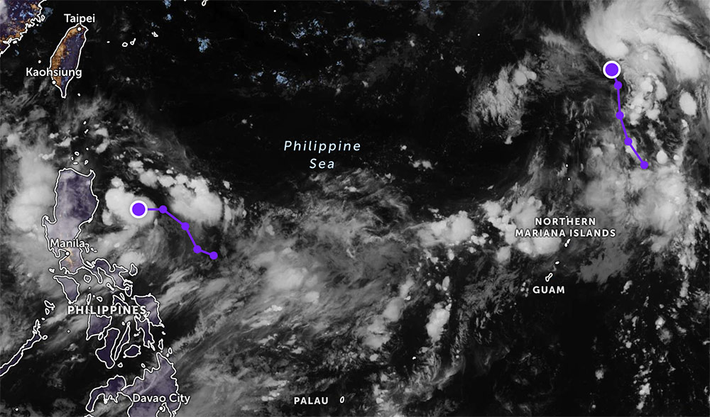
In addition, a low pressure in the Philippine area of responsibility is forecast to strengthen into a tropical depression in the next 24 hours. At 8:00 p.m. on July 1, the low pressure was at about 16.5 degrees North latitude, 124.0 degrees East longitude, about 200km from the Philippine mainland.
During the complicated weather period, visitors need to prepare backup plans and update information continuously to ensure safety.


