According to storm news, the latest low pressure from the Joint Typhoon Warning Center (JTWC), a low pressure is strengthening in the Pacific Ocean.
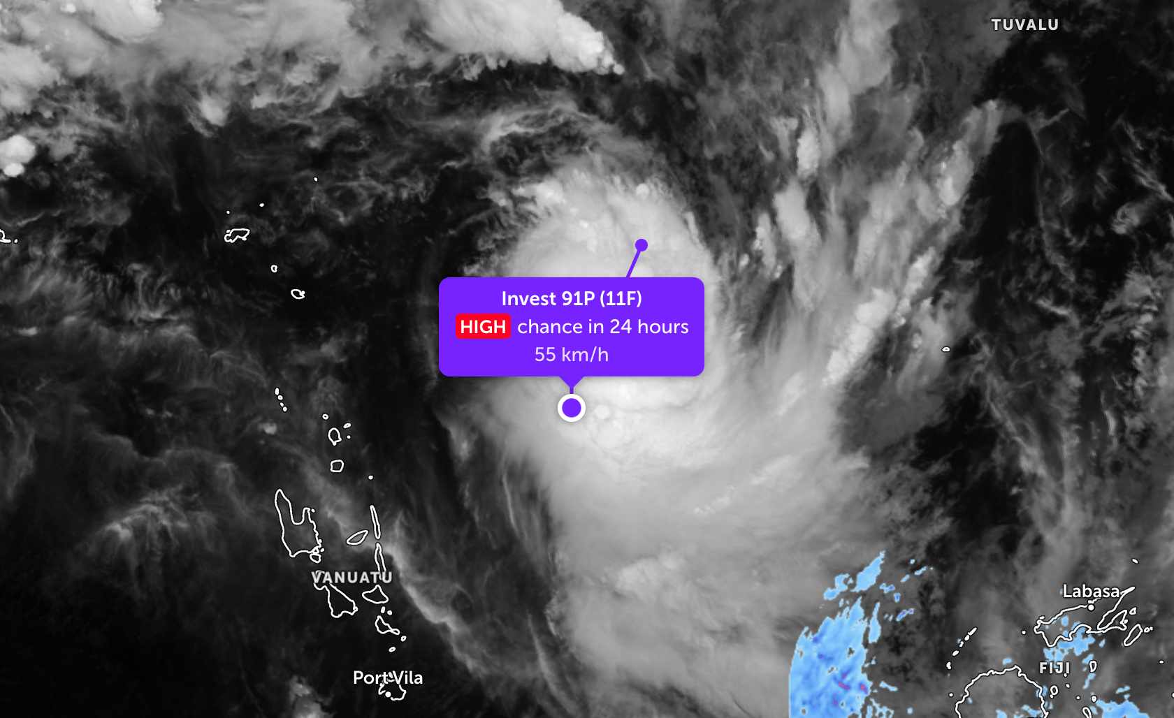
As of the evening of April 4, the location of the low pressure center with the symbol Invest 91P is currently near Vanuatu in the South Pacific. The strongest wind near the low pressure center reaches 45-55 km/h, gusting up to 65 km/h.
JTWC forecasts that the low pressure is highly likely to strengthen into a tropical depression or storm in the next 24 hours.
Meanwhile, storm Maila is currently about 1,328 km northeast of Cairns (Australia). In the past 6 hours, the storm has moved northwest at a speed of 11 km/h in the past 6 hours. High waves at maximum 4.9 m.
The storm moved almost nowhere in the Solomons Sea. However, favorable environmental conditions caused the storm to continuously strengthen in the next 3 days, before gradually weakening due to cold water rising on the sea.
Predicted models all show that storm Maila is likely to strengthen in 3 days, with a maximum level of about 150-205 km/h. After that, the storm will gradually weaken in the following days.
Because storms and low pressures are still far from the mainland, they have not affected the weather of islands and countries in the region. However, people and tourists should still regularly monitor weather forecasts and check flight schedules to proactively travel.


