According to low pressure and new storm news from the Joint Typhoon Warning Center (JTWC), tropical depression 37U has officially strengthened into tropical storm 30P.
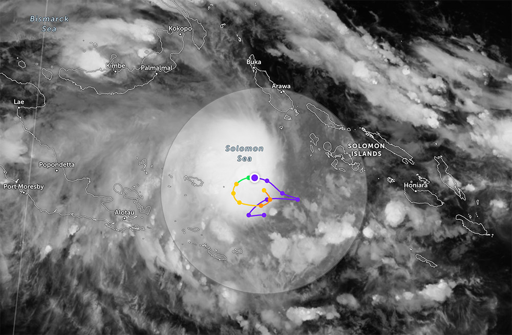
The eye of the storm is located about 1,328km northeast of Cairns (Australia), moving northwest at a speed of about 11km/h in the past 6 hours. The maximum recorded significant wave height is about 4.9m, indicating that sea conditions have begun to worsen.
For the next three days, tropical storm 30P is forecast to be in a complex navigation environment, making movement very slow and almost "stuck" in the Solomon Sea area.
International forecast models are relatively consistent in suggesting that the storm will move slowly westward.
However, most scenarios predict that the storm will operate in eastern Papua New Guinea throughout the forecast period.
Current environmental conditions are assessed to be favorable for the storm's intensification process.
Some strong intensity forecast models (such as HAFS-A, HWRF) even suggest that the storm can reach maximum winds of about 205km/h. However, the JTWC offers a more cautious scenario, with a maximum intensity of about 150km/h.
With its slow movement and complex direction, storm 30P may affect sea conditions in the Solomon Sea area and surrounding areas.
When the tropical depression turned into storm 30P between Papua New Guinea and the Solomon Islands, this weather diễn biến raised concerns about the possibility that the northern Queensland region - a famous tourist destination of Australia - will continue to be affected after Hurricane Narelle swept through.
Tourists planning to visit sea and island areas near Papua New Guinea or northeastern Australia need to continuously monitor low pressure forecasts and storm forecasts.
Proactively adjust schedules, especially for sea and island tours. Avoid offshore activities when there is warning of strong winds and big waves.
Meanwhile, the National Center for Hydro-Meteorological Forecasting forecasts the sea weather for the night of April 4 and the day of April 5, the North and South of the Gulf of Tonkin, from Quang Tri to Quang Ngai will have light rain in some places, visibility over 10km, southeast to south wind level 4-5, waves 1.0 - 2.0m high. From Gia Lai to Khanh Hoa, Lam Dong to Ca Mau and the area from Ca Mau to An Giang almost no rain, light wind level 3-4, low waves 0.5 - 1.5m.
In the East Sea, the northeastern area of the North East Sea has scattered showers and thunderstorms, potentially tornadoes and strong gusts, visibility reduced to 4-10km in rain, waves 1.5 - 2.5m high.
The remaining sea areas such as Hoang Sa Special Zone, central and southern East Sea, Truong Sa Special Zone mainly have light rain in some places or no rain, wind from light to level 4-5, waves commonly 0.5 - 2.0m. In the Gulf of Thailand, the weather is stable, no rain, low waves below 1.0m.


