According to storm news, the latest low pressure from the Joint Typhoon Warning Center (JTWC), two low pressures are following each other operating in the Pacific Ocean.
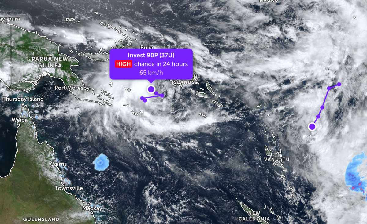
The low pressure bearing the symbol Invest 90P (Tropical Low 37U) is currently located near the Solomon Islands in the South Pacific. The low pressure moves in a zigzag motion with the strongest wind near the center reaching 65 km/h.
JTWC forecasts that the low pressure is highly likely to strengthen into a tropical depression or storm in the next 24 hours.
The second low pressure, coded Invest 91P, is currently located near Vanuatu in the South Pacific. The strongest wind near the center of the low pressure reaches 45-50 km/h.
The low pressure moves in a South - Southwest direction towards Vanuatu. JTWC forecasts that the low pressure is unlikely to develop into a tropical depression or storm in the next 24 hours.
Because it is still quite far from the mainland, the low pressure has not caused much impact on the adjacent mainland areas.
Meanwhile, Typhoon Induasa is strongly strengthening in the Indian Ocean. The storm is currently located about 1,193 km south of Diego Garcia, moving south-southwest at a speed of 26 km/h in the past 6 hours. The maximum wave height reaches about 6.4 m.
The strongest wind near the storm center reaches 120 km/h. In the next 12 hours, the storm may reach a maximum intensity of 140 km/h.
The storm is forecast to strengthen to its maximum and then weaken into a tropical depression in the next 2 days.
People and tourists planning to go to sea areas where storms and low pressures pass through should pay attention to weather forecasts. Regularly check flight schedules and follow local instructions to avoid dangerous storms.


