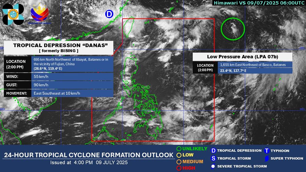
According to new low pressure information from the Philippine Atmospheric, Geophysical and Astronomical Services Administration (PAGASA), a low pressure area is currently being monitored outside the Philippine Area of Responsibility (PAR).
As of 2:00 p.m. on July 9 (local time), the center of the low pressure was at about 23.4 degrees North latitude - 137.7 degrees East longitude, about 1,655km East Northeast of Basco, Bantanes. The low pressure is unlikely to develop into a tropical depression in the next 24 hours.
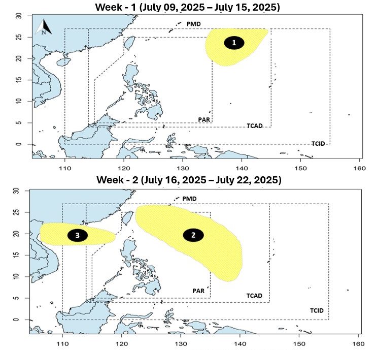
PAGASA forecasts that during the week of July 16-22, another low pressure is likely to appear within the Philippine Area of Responsibility. However, this low pressure is unlikely to develop strongly into a tropical depression.
Meanwhile, the third low pressure area will appear in the week of July 16-22, right in the East Sea. This low pressure is forecast to have the potential to develop into a storm.
If it becomes a storm, this will be the third storm to hit the East Sea this year and will directly affect the sea areas of our country.
According to the National Center for Hydro-Meteorological Forecasting, from now until September 2025, storms/tropical depressions active in the East Sea and affecting our country are likely to be at a level close to the TBNN. That is, there are about 6-7 storms in the East Sea, about 3 storms/tropical depressions making landfall.
Dangerous weather phenomena such as thunderstorms, tornadoes, lightning, hail and strong gusts of wind continue to occur nationwide.
From July to September 2025, moderate and heavy rains are likely to appear in the Northern, North Central, Central Highlands and Southern regions. Meanwhile, the heat will be concentrated in the Northern and Central regions until August 2025, and from September 2025, the heat will gradually decrease.
Storms, tropical depressions and the southwest monsoon cause strong winds and large waves affecting the activities of ships and boats. The phenomenon of hot weather, heavy rain and thunderstorms, tornadoes and lightning can negatively affect production activities and public health.
People and tourists planning to travel to the northern coastal areas in the next 2 weeks should pay attention to weather forecasts. Follow local instructions to ensure safety.


