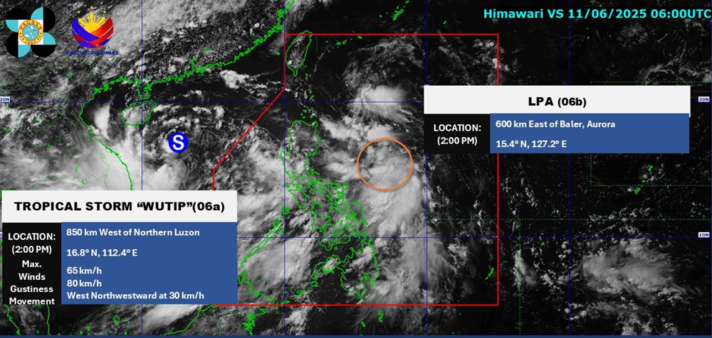
According to the latest weather forecast from the Philippine Atmospheric, Geophysical and Astronomical Services Administration ( pagasa), as of 3:00 p.m. on June 11, a new low pressure area was being monitored in the Philippine Area of Responsibility (PAR).
The center of the low pressure is located at about 15.5 degrees North latitude - 127.2 degrees East longitude, about 600km east of Baler, Aurora. The possibility of the low pressure developing into a tropical depression in the next 24 hours is forecast to be average.
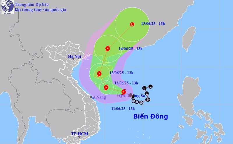
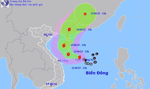
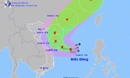
Meanwhile, storm No. 1 WUTIP is continuing to strengthen in the East Sea. According to the National Center for Hydro-Meteorological Forecasting, at 1:00 p.m. on June 11, the center of storm No. 1 (storm WUTIP) was at about 16.7 degrees North latitude - 112.5 degrees East longitude, in the sea east of Hoang Sa archipelago.
The strongest wind near the storm center is level 8 (62-74km/h), gusting to level 10. The storm is moving west-northwest at a speed of 10-15km/h.
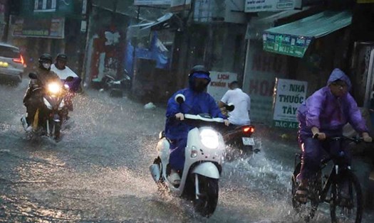
Due to the influence of storm No. 1, from the afternoon of June 11 to June 13, in the Central Central region, there will be heavy to very heavy rain with common rainfall from 100-300mm, some places over 450mm.
The Northern Central Highlands region will have moderate rain, heavy rain and thunderstorms, locally very heavy rain with common rainfall from 70-150mm, some places over 200mm.
The National Center for Hydro-Meteorological Forecasting warned that in the next 6 hours, there is a risk of flash floods, landslides, and land subsidence on steep slopes and small streams in Quang Nam (Bac Tra My, Dai Loc, Duy Xuyen, Hiep Duc, Nam Giang, Nam Tra My, Nui Thanh, Phu Ninh, Phuoc Son, Que Son, Tien Phuoc), Da Nang (Hoa Vang, Lien Chieu District, Ngu Hanh Son District, Son Tra District), Binh Phuoc (Bu Dang, Bu Gia Map, Dong Phu, Loc Ninh, Dong Xoai City).
From the night of June 11 to June 14, there is a possibility of a flood on the rivers from Quang Binh to Quang Ngai. During this flood, the peak water level is likely to reach alert level (BD)1 and above BD1.
There is a high risk of flooding in low-lying areas along rivers, flash floods and landslides on steep slopes in mountainous areas of provinces from Quang Binh to Quang Ngai.
The Central and South East Sea area (including the Truong Sa archipelago), the South Gulf of Tonkin, the sea area from Quang Tri to Ca Mau, Ca Mau to Kien Giang and the Gulf of Thailand will have showers and thunderstorms.
Ly Son island station has strong gusts of wind level 7; Phu Quy has strong southwest wind level 6; Huyen Tran has strong southwest wind level 6, gust level 9; Truong Sa has strong gusts of wind level 7; Phu Quoc has strong gusts of wind level 7; Con Dao has strong gusts of wind level 7.
People and tourists planning to visit the above areas should pay attention to weather forecasts and check flight schedules. Follow the instructions and recommendations of local authorities to have a safe trip.