According to the latest storm news from the Joint Typhoon Warning Center (JTWC), a new low pressure has formed in the Pacific Ocean.
As of this morning, June 2nd, the location of the low pressure center with the symbol Invest 90E is located in the eastern Pacific region. The strongest wind near the low pressure center reaches 35 km/h.
The current low pressure has a 60% chance of developing into a tropical depression or tropical storm in the next 48 hours and increasing to 90% in the next 7 days.
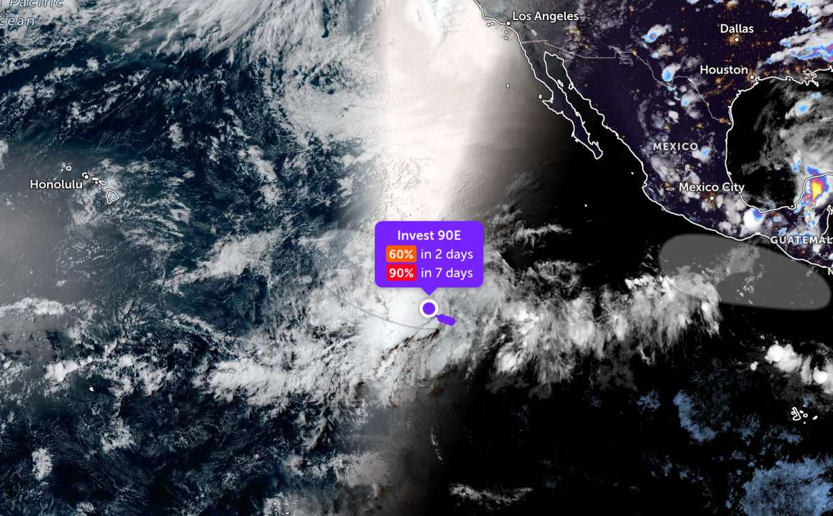
According to satellite images observed during the day, the low pressure area is quite far southwest of the southern tip of the Baja California peninsula (Mexico). Therefore, the low pressure only causes thunderstorms at sea, not affecting these mainland areas.
Experts believe that environmental conditions at sea are favorable for the process of strengthening the low pressure. It is forecast that a tropical depression may form in the next few days as the disturbance area continues to move west or west-northwest at a speed of about 16 km/h over the western sea of the Eastern Pacific.
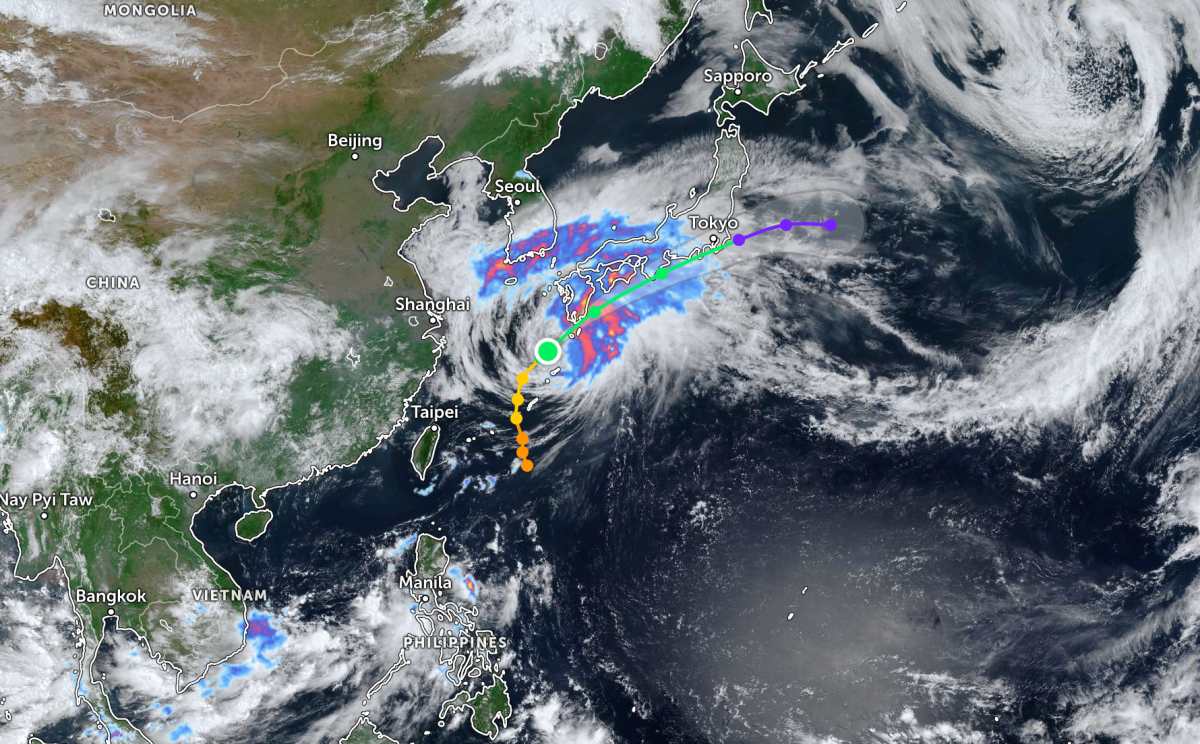
Meanwhile, Typhoon Jangmi is moving rapidly towards the mainland area south of Japan. The typhoon's center is located about 1,258 km west-southwest of Yokosuka city (Japan). The strongest wind near the typhoon's center reaches 95 km/h.
In the past 6 hours, the storm has moved in the Northeast direction at a speed of about 30 km/h. The area near the storm center recorded a maximum wave height of up to 9.8 m, strong sea waves.
The storm is expected to make landfall in Japan today or tomorrow, June 3, causing widespread rain in some islands and the southern mainland of this country.
People and tourists planning to go to the storm-stricken area should pay attention to weather forecasts. Check flight schedules and follow local instructions to avoid dangerous storms throughout the journey.


