According to the new weather forecast from the Philippine Atmospheric, Geophysical and Astronomical Services Administration (PAGASA), currently, storm No. 2 Danas is moving in the mainland area of Zhejiang Province (China) and weakening into a low pressure area.
As of 2:00 a.m. on July 10 (local time), the center of the low pressure was at about 23.5 degrees North latitude - 116.1 degrees East longitude, on the mainland of Zhejiang Province (Zhejiang). The low pressure is unlikely to strengthen in the next 24 hours.
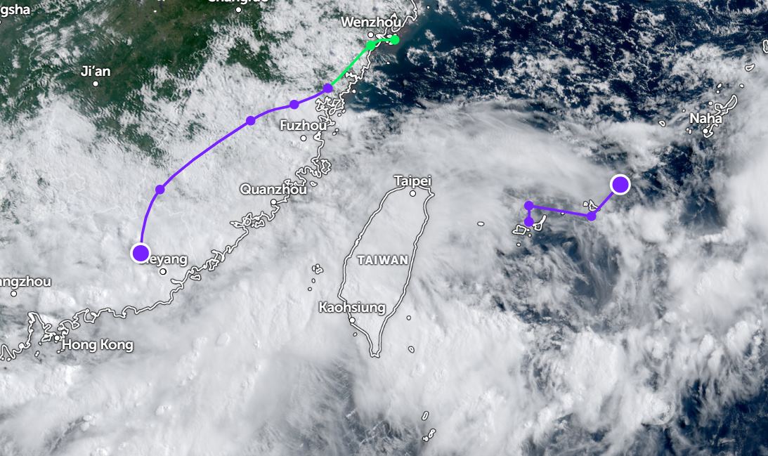
Meanwhile, a new low pressure is being monitored in the Philippine Area of Responsibility (PAR), near the northern part of the East Sea. The center of the low pressure is located at about 24.6 degrees North latitude - 125.0 degrees East longitude, about 535km northeast of Itbayat, Bantanes.
The low pressure is unlikely to develop into a tropical depression in the next 24 hours.
According to the National Center for Hydro-Meteorological Forecasting, as of 4:00 a.m. on July 10, the northeastern sea area of the North East Sea will have showers and thunderstorms.
Forecast for the day and night of July 10, the northern area of the Gulf of Tonkin, the northern area of the North East Sea, the sea area from Khanh Hoa to Ho Chi Minh City and the central East Sea area, the Gulf of Thailand will have scattered showers and thunderstorms. During thunderstorms, there is a possibility of tornadoes and strong gusts of wind. Southwest wind level 5, sometimes level 6, gust level 7-8. Waves are 2.0 - 3.5m high, rough seas.
Ships operating in the above areas need to be on guard against tornadoes, strong gusts of wind and big waves.
People and tourists planning to visit Zhejiang province (China), the sea area from Khanh Hoa to Ho Chi Minh City, should pay attention to weather forecasts. Check flight schedules and follow local instructions to avoid impactful storms.


