According to the National Center for Hydro-Meteorological Forecasting, at 13:00 on June 3, the low pressure area was located at about 15.5-16.5 degrees North latitude - 113.5-114.5 degrees East longitude in the East Sea. At Phu Quy station, there was strong wind at level 5, sometimes level 6; Huyen Tran station had strong gusts at level 9.
The low pressure area moves in the Northeast direction and is likely to strengthen into a tropical depression.
Forecast for the night of June 3rd and day of June 4th, the southern area of the Northern East Sea and the central East Sea area will have strong winds of level 6, gusts of level 7-8. Sea rough. Waves 2.0-4.0 m high.
The sea area from Khanh Hoa to Ca Mau, the South East Sea area (including Truong Sa special zone) has strong winds of level 6, gusts of level 7-8. Seas are rough. Waves are 2.0-4.0 m high.
In addition, on the night of June 3 and day of June 4, the North and Central East Sea areas (including the Hoang Sa special zone), the sea area from Gia Lai to Ca Mau, Ca Mau to An Giang and the Gulf of Thailand will have showers and thunderstorms. In thunderstorms, there is a possibility of tornadoes and strong gusts of wind at level 7-8.
On the night of June 4 and June 5, the sea area east of the Northern East Sea, the Central and Southern East Sea (including Truong Sa special zone), the sea area from Khanh Hoa to Ho Chi Minh City will have strong southwest winds of level 6, gusts of level 7-8; rough seas; waves 2.0-4.0m high.
Meanwhile, according to storm news, the latest low pressure from the Joint Typhoon Warning Center (JTWC), the low pressure in the Pacific Ocean has strengthened into a tropical depression.
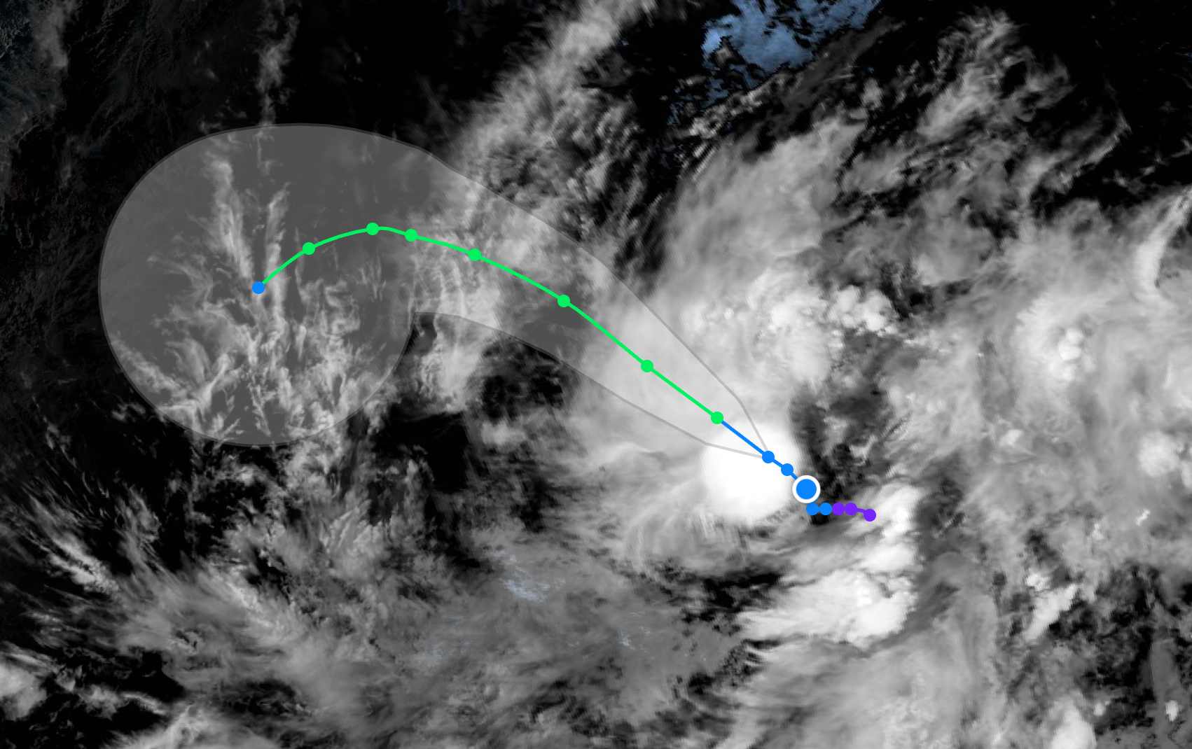
As of the afternoon of June 3, the center of the tropical depression is located in the eastern Pacific region. The strongest wind near the center of the tropical depression reached 55 km/h.
The low pressure moves faster and faster in the direction of Northwest to Northwest. Then, this system is forecast to shift to the West and then Southwest as a high pressure ridge develops in the Northwest.
The tropical depression is forecast to strengthen into a storm today. The storm will continue to strengthen at sea until it reaches maximum intensity (wind speed 85 km/h), then will gradually weaken and dissipate at the beginning of next week.
Because it is still quite far from the mainland, the tropical depression only causes thunderstorms at sea, not affecting adjacent mainland areas.
People and tourists planning to go to sea areas where low pressure and tropical depressions pass through should pay attention to weather forecasts. Follow local instructions to avoid storms and big waves at sea that are dangerous.


