According to storm news, the latest low pressure from the Joint Typhoon Warning Center (JTWC), this afternoon March 24, the tropical depression weakened from Typhoon Narelle has strengthened back to tropical storm level in the coastal area west of Australia.
The storm's center is located 246 km north-northeast of Broome (Australia). In the past 6 hours, the storm has moved in a westerly direction at a speed of 20 km/h. The strongest wind near the low pressure center reached about 75 km/h, the maximum wave height reached 4.6 m.
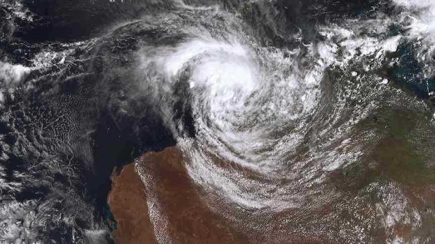
JTWC forecasts that Typhoon Narella will continue to strengthen into a Category 2 tropical storm tonight, March 24, with maximum winds reaching 95 km/h. The storm will strengthen fiercely and reach Category 3 with winds of 165 km/h in the early morning of Friday, before making landfall in Australia for the 3rd time.
A storm warning has been issued for the area from Beagle Bay to Kuri Bay. The storm watch covers the area from Cape Preston to the Wallal Downs, including Karratha and Port Hedland.
Severe weather warnings were also issued in the area with the risk of strong winds causing damage and heavy rain in the mainland areas where the storm passed through.
Tourists planning to visit Western Australia and storm-affected areas should pay attention to regularly updating weather forecasts. Check your flight schedule and follow local instructions to avoid dangerous storms.
Meanwhile, the typhoon coded 28P is currently located 289 km southwest of Noumea (New Caledonia) in the Pacific Ocean. In the past 6 hours, the typhoon has moved south at a speed of 41 km/h. The strongest wind near the storm center reached 85 km/h, the maximum wave height reached 5.5m.
JTWC forecasts that storm 28P will quickly weaken into a low pressure before dissipating tomorrow, March 25.


