According to storm news, the latest low pressure from the Joint Typhoon Warning Center (JTWC), on the evening of March 23, tropical depression 35U over the South Pacific Sea has officially strengthened into a storm.
The typhoon coded 28P is about 400 km west-northwest of Noumea (New Caledonia). In the past 6 hours, the typhoon has moved south at a speed of 30 km/h.
The strongest wind near the storm center reaches 85 km/h. The maximum significant wave height reaches 5.5 m.
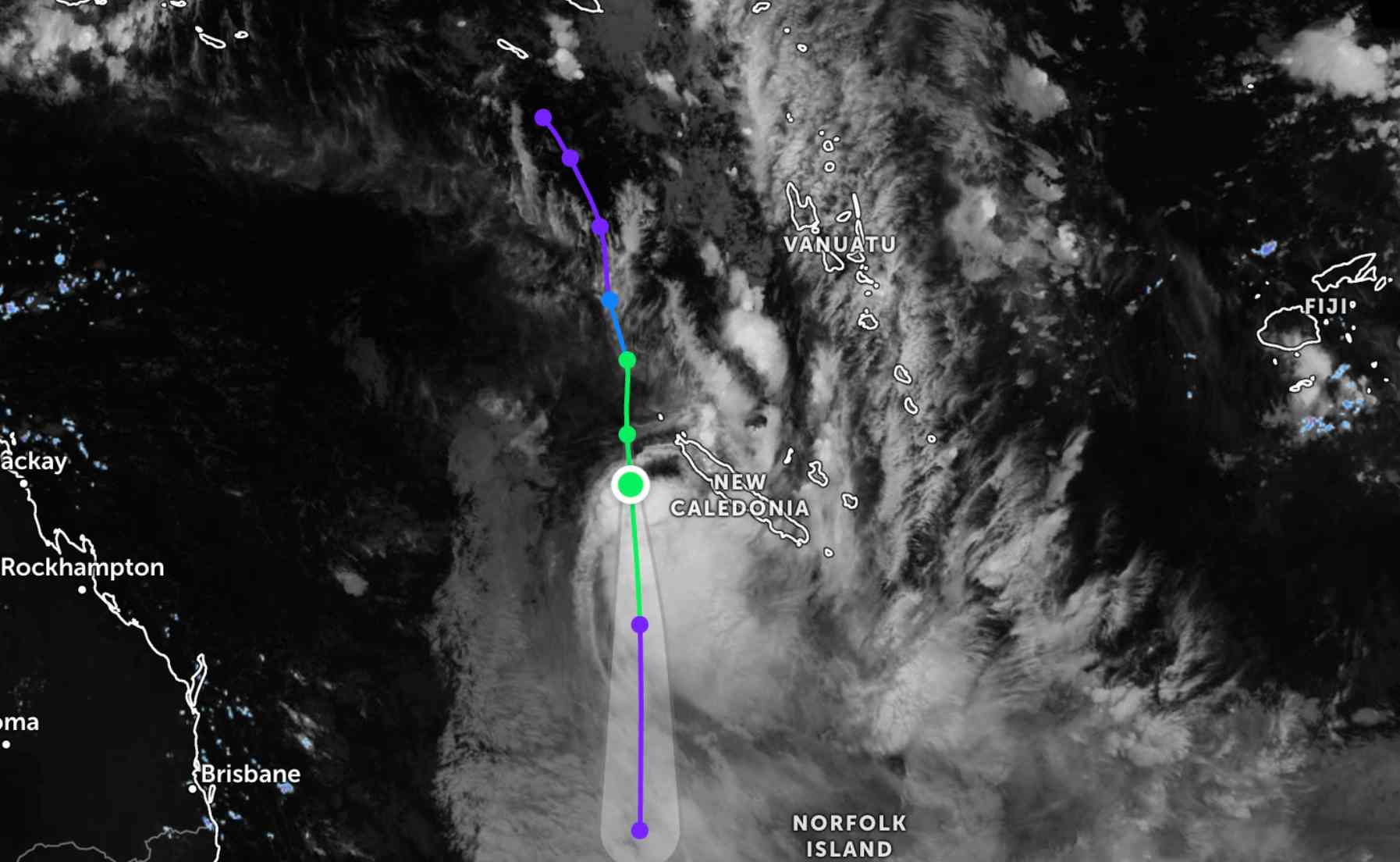
Forecast for the next 24 hours, storm 28P will continue to move south, along the western edge of the subtropical high pressure. JTWC predicts that the storm will continue to strengthen in the next 12 hours, with gusts up to 95 km/h, then maintain stable intensity for the next 24 hours.
Because it is still far from the mainland, the storm has not affected the mainland areas in the area.
Meanwhile, the tropical depression weakened from Hurricane Narelle is hovering over land in northern Australia. The center of the low pressure is currently about 528 km southwest of Darwin (Australia).
The strongest wind near the center of the tropical depression reached 65 km/h. In the past 6 hours, the tropical depression has moved in a West - Southwest direction at a speed of 24 km/h.
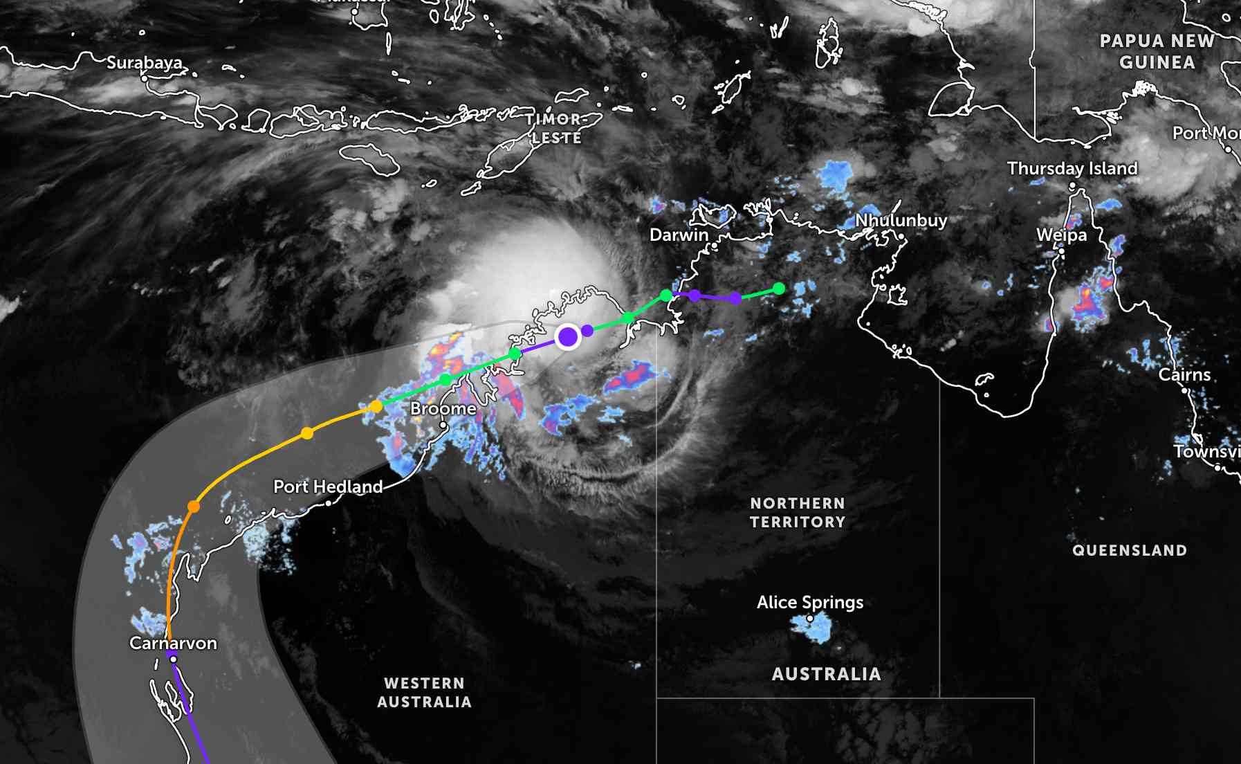
The tropical depression will continue to move in a West - Southwest direction under the direction of the subtropical high pressure in the South and develop strongly into a storm again.
Forecast for the next 12 hours, the storm will move along the coast of Kimberley, then move back to the South Indian Ocean, southeast of Adele Island.
Hurricane Narelle is forecast to sweep along the West Australian coast, moving close to the west of the Exmouth Peninsula and the Learmonth area in the coming days.
It is forecast that the storm will develop strongly again with a maximum intensity of about 185-195 km/h in the next 3 days.
Hurricane Narelle causes widespread heavy rain and gusts of wind in the sea and mainland areas of northern and western Australia. Tourists planning to travel to Australia, especially to Western Australia, Perth neighborhoods... should pay attention to weather forecasts. Regularly check flight schedules to proactively arrange trips, follow local instructions to ensure safety.


