According to storm news, the latest low pressure from the Joint Typhoon Warning Center (JTWC), this morning March 24, a weakening tropical depression from Typhoon Narelle is operating complicatedly in the coastal area of Northern Australia.
The center of the tropical depression is located 361 km northeast of Broome, Australia. In the past 6 hours, the depression has moved southwest at a speed of 19 km/h. The strongest wind near the center of the depression reached about 65 km/h.
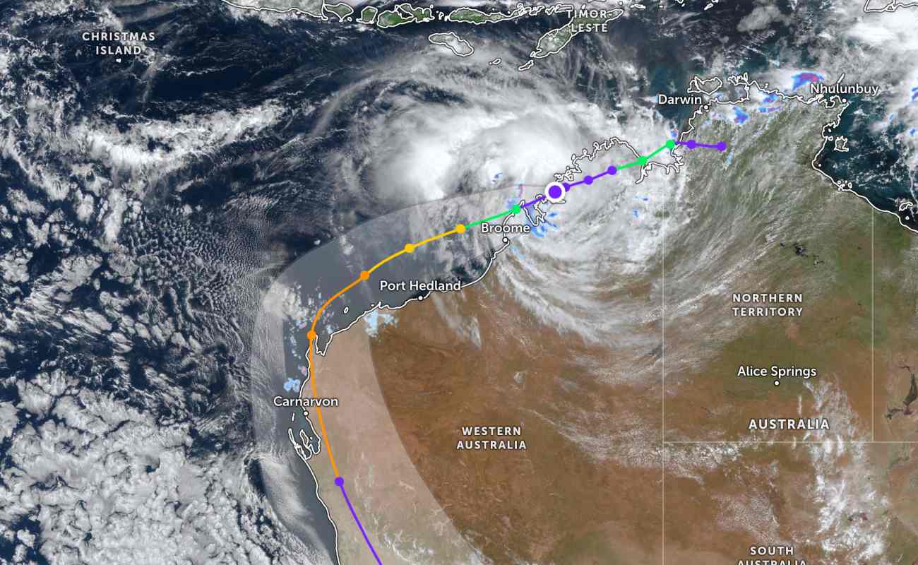
According to the Australian Bureau of Meteorology (BOM), Hurricane Narelle is moving out of the west coast of Kimberley, with a high probability of strengthening into a storm over the Indian Ocean tonight.
This is the third mainland area that Hurricane Narelle will affect after sweeping through the North Queensland and the Top End in Northern Territory.
Currently, a storm warning has been issued for the area from Beagle Bay to Kuri Bay, and a storm watch for the area from Cape Preston to the Wallal Downs, including Karratha and Port Hedland.
Severe weather warnings were also issued in the area with the risk of strong winds causing damage and heavy rain.
Within 11 hours up to 9am this morning, recorded rainfall reached about 146 mm in Kalumburu and 166 mm in Truscott.
Senior BOM meteorologist Jonathan How said: "It is forecast that by Tuesday evening, this system may strengthen again into a tropical storm just north of Broome and still retain the name Narelle.
By Wednesday morning, the storm could reach level 2. In the second half of the week, Narelle is forecast to continue moving southwest and is likely to strengthen into a severe level 3 storm on Wednesday evening.
Currently, dangerous weather warnings have been issued for some areas in Western Australia.
Tourists planning to visit Western Australia and storm-affected areas should pay attention to regularly updating weather forecasts. Check your flight schedule and follow local instructions to avoid dangerous storms.


