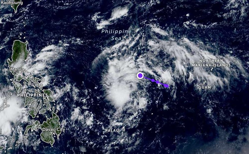
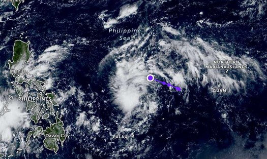
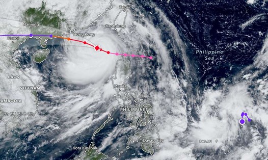
According to the National Center for Hydro-Meteorological Forecasting, at 7:00 p.m. on October 1, the center of the tropical depression was at about 14.8 degrees North latitude - 129.8 degrees East longitude, in the sea east of the Philippines. The strongest wind near the center of the tropical depression is level 7 (50-61km/h), gusting to level 9. Moving in the West Northwest direction, speed about 15km/h.
It is forecasted that by 7:00 p.m. on October 2, the tropical depression will move in the West Northwest direction at a speed of about 15-20km/h and is likely to strengthen into a storm. If it becomes a storm, this will be the 11th storm to enter the East Sea this year.
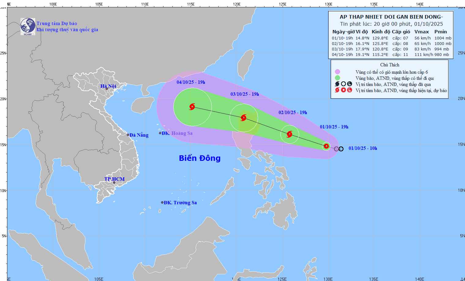
The center of the storm is located at about 16.1 degrees North latitude - 125.8 degrees East longitude, in the sea east of Luzon Island (Philippines). The strongest wind near the storm center is level 8, gusting to level 10.
By 7:00 p.m. on October 3, the storm will move west-northwest at a speed of about 20-25 km/h, likely to strengthen.
The center of the storm is located at about 17.9 degrees North latitude - 120.8 degrees East longitude, in the area north of Luzon Island. The strongest wind near the storm center is level 9, gusting to level 11. Natural disaster risk level: Level 3 for the eastern sea area of the North East Sea.
It is forecasted that in the next 48 to 72 hours, the storm will move in the West Northwest direction, traveling about 25km per hour, entering the East Sea and continuing to strengthen.
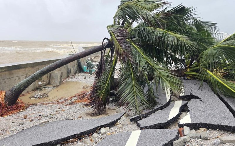
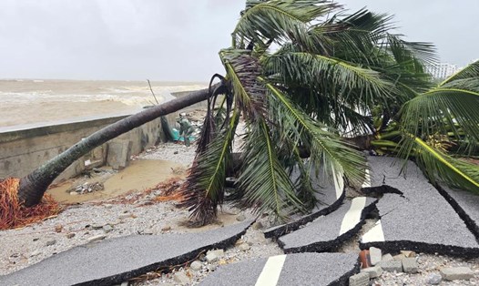
Due to the influence of the tropical depression about to strengthen into a storm, from the afternoon of October 3, the eastern sea area of the North East Sea will have winds gradually increasing to level 6-7; then increasing to level 8, the area near the storm's eye will have strong winds of level 9-10, gusts of level 12, waves 4.0-6.0m high. The sea is very rough.
During October 4-6, the North East Sea area (including Hoang Sa special zone) is likely to be affected by strong winds of level 11-12, gusting to level 15.
Ship operating in the above-mentioned dangerous areas are likely to be affected by thunderstorms, whirlwinds, strong winds, and large waves.
People and tourists planning to visit these coastal areas should pay attention to weather forecasts. Tuan follows local instructions to ensure safety.